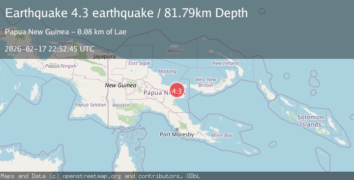
Earthquake eastern New Guinea region, Papua New Guinea
Tue, 17 Feb 2026 22:52:45 GMT
Time1 month ago
Location
-6.0076, 147.1762
Depth
81.8 KM
Event Summary
A 4.3 magnitude earthquake struck on eastern New Guinea region, Papua New Guinea, at Tue, 17 Feb 2026 22:52:45 GMT. Depth: 81.787109375km. Reviewed by VYT seismologists, this light quake occurred at a magnitude type of earthquake.
Magnitude
4.3
earthquake
Source
VYT
Intensity
II
Agency Reports
2 Sources| Source | Magnitude | Depth | Time |
|---|---|---|---|
| VYTPrimary | 4.3 | 82 km | 1 month ago |
| NEIC | 4.6 | 81 km | 1 month ago |
Earthquake Details
AutomaticEvent IDvyt_3vikjk2e0wz9o
QualityC
Tsunami PotentialNo
Magnitude Typeearthquake
Last Update1 month ago
Total Stations32
Felt Reports0
Did you feel this earthquake? Report it to help others.
No reports yet
Be the first to report this earthquake!
Latest Earthquakes
Loading...
Nearby Earthquakes
4.9Mag
eastern New Guinea region, Papua New Guinea
Time1 week ago
Depth60.30 km
SourceVYT (Automatic)
3.6Mag
eastern New Guinea region, Papua New Guinea
Time2 weeks ago
Depth127.93 km
SourceVYT (Automatic)
4.7Mag
eastern New Guinea region, Papua New Guinea
Time3 weeks ago
Depth186.89 km
SourceVYT (Automatic)
3.8Mag
eastern New Guinea region, Papua New Guinea
Time3 weeks ago
Depth254.03 km
SourceVYT (Automatic)
3.5Mag
eastern New Guinea region, Papua New Guinea
Time1 month ago
Depth96.07 km
SourceVYT (Automatic)