Earthquake California-Baja California border region
Sun, 10 May 2026 03:13:19 GMT
Time19 hours ago
Location
32.9555, -115.5459
Depth
20.6 KM
Event Summary
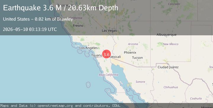
A 3.6 magnitude earthquake struck on California-Baja California border region, at Sun, 10 May 2026 03:13:19 GMT. Depth: 20.6298828125km. Reviewed by VYT seismologists, this minor quake occurred at a magnitude type of M.
Magnitude
3.6
M
Source
VYT
Intensity
III
Agency Reports
4 Sources| Source | Magnitude | Depth | Time |
|---|---|---|---|
| VYTPrimary | 3.6 | 21 km | 19 hours ago |
| SCSN | 4.0 | 10 km | 19 hours ago |
| USGS | 3.5 | 10 km | 19 hours ago |
| NEIC | 3.9 | 10 km | 19 hours ago |
Earthquake Details
AutomaticEvent IDvyt_7ew8znczhe3l
QualityB
Tsunami PotentialNo
Magnitude TypeM
Last Update18 hours ago
Used Stations70
Total Stations45
Nearest Places
Possibly felt by: 297.8K
- IIIBrawley3.0 km25.9K people
- IIIWestmorland11.5 km2.3K people
- IIIImperial12.2 km17.1K people
- IIIEl Centro18.3 km44K people
- IIICalipatria19.1 km7.4K people
- IIIHoltville22.3 km6.4K people
- IIISeeley22.6 km1.7K people
- IIIHeber25.0 km4.3K people
- IICalexico31.1 km40.1K people
- IINiland31.7 km1K people
- 35.9 km29.3K people
- 36.5 km2.5K people
- IIMexicali37.4 km1M people
- IIProgreso41.9 km12.6K people
- 43.2 km2K people
- IIPuebla46.9 km15.2K people
- 47.1 km1.1K people
- 52.2 km2.5K people
- 54.0 km3.8K people
- 57.5 km1.6K people
- 58.3 km1.1K people
- 58.8 km3.1K people
- 62.5 km2.5K people
- 67.2 km4.2K people
- 67.5 km1.8K people
- 67.7 km1.7K people
- 67.8 km1.1K people
- 68.1 km5.3K people
- 69.2 km3.7K people
- 69.4 km2.3K people
- 71.0 km1.6K people
- 72.6 km1K people
- 72.7 km1.1K people
- 72.9 km1.5K people
- 74.4 km5.2K people
- 76.4 km5.1K people
- 76.6 km6.9K people
- 78.8 km2.4K people
- 79.9 km1.5K people
- 80.8 km1.5K people
- 81.1 km4.9K people
- 81.1 km1.1K people
- 83.3 km1.6K people
- 84.1 km3.4K people
- 84.2 km4.3K people
- 84.6 km8.6K people
- 84.8 km17.1K people
- 85.6 km1.5K people
- 86.8 km4.2K people
- 87.5 km6.1K people
- 87.8 km15K people
- 88.4 km8.1K people
- 88.4 km31.5K people
- IYuma89.8 km94.1K people
- 89.8 km1.8K people
- 91.3 km176.7K people
- 93.0 km1.5K people
- 93.3 km1K people
- 94.0 km2.9K people
- 94.6 km2.7K people
- 94.9 km1.7K people
- 97.4 km2.9K people
- 98.7 km5.6K people
- 99.1 km7.6K people
- 99.4 km1.5K people
- 99.5 km44.6K people
- 100.5 km1.4K people
Felt Reports0
Did you feel this earthquake? Report it to help others.
No reports yet
Be the first to report this earthquake!
Latest Earthquakes
Loading...
Nearby Earthquakes
1.6Mag
4 km SW of Brawley, CA
Time18 hours ago
Depth3.49 km
SourceUSGS (Automatic)
1.8Mag
3 km SW of Brawley, CA
Time18 hours ago
Depth8.46 km
SourceUSGS (Automatic)
1.9Mag
3 km SW of Brawley, CA
Time18 hours ago
Depth8.01 km
SourceUSGS (Automatic)
1.7Mag
2 km SW of Brawley, CA
Time18 hours ago
Depth5.29 km
SourceUSGS (Automatic)
1.6Mag
4 km SSW of Brawley, CA
Time18 hours ago
Depth3.78 km
SourceUSGS (Automatic)