Earthquake southern Sumatra, Indonesia
Tue, 03 Mar 2026 18:42:46 GMT
Low Quality Data Warning
This earthquake may be wrong/incorrect, it is recommended not to spread this information because there is a possibility that further updates are needed for data accuracy.
Time1 month ago
Location
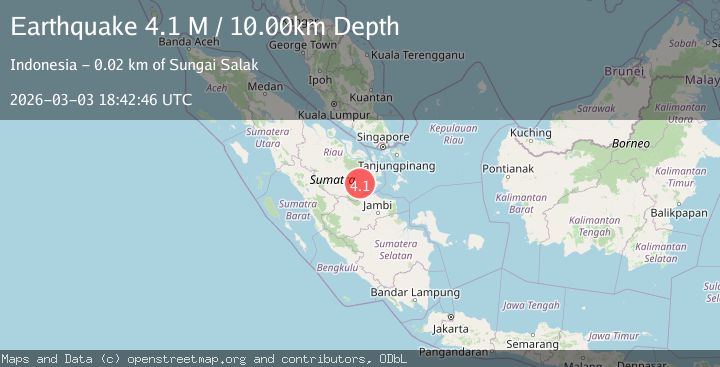
-0.3096, 102.8720
Depth
10.0 KM
Event Summary
A 4.1 magnitude earthquake struck on southern Sumatra, Indonesia, at Tue, 03 Mar 2026 18:42:46 GMT. Depth: 10km. Reviewed by VYT seismologists, this light quake occurred at a magnitude type of M.
Magnitude
4.1
M
Source
VYT
Intensity
IV
Agency Reports
1 Sources| Source | Magnitude | Depth | Time |
|---|---|---|---|
| VYTPrimary | 4.1 | 10 km | 1 month ago |
Earthquake Details
AutomaticEvent IDvyt_9p0gu7jj3sy8
QualityD
Tsunami PotentialNo
Magnitude TypeM
Last Update1 month ago
Total Stations4
Nearest Places
Possibly felt by: 9.3K
- 20.8 km
- IIITembilahan32.1 km
- IIIRengat36.8 km
- IIIEnok42.9 km
- IIISapat48.7 km
- 54.4 km
- 56.0 km
- 62.0 km
- 64.8 km
- 78.7 km
- 86.4 km33.7K people
- 96.0 km
- 102.2 km
- 103.4 km
- 105.3 km
- 112.3 km56.3K people
- 113.7 km
- 123.5 km
- 126.2 km
- 126.4 km
- 128.2 km
- 137.4 km
- 138.2 km
- 142.4 km
Felt Reports0
Did you feel this earthquake? Report it to help others.
No reports yet
Be the first to report this earthquake!
Latest Earthquakes
Loading...