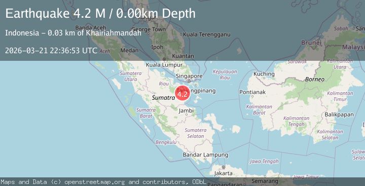
Earthquake northern Sumatra, Indonesia
Sat, 21 Mar 2026 22:36:53 GMT
Low Quality Data Warning
This earthquake may be wrong/incorrect, it is recommended not to spread this information because there is a possibility that further updates are needed for data accuracy.
Time2 weeks ago
Location
0.2325, 103.3007
Depth
0.0 KM
Event Summary
A 4.2 magnitude earthquake struck on northern Sumatra, Indonesia, at Sat, 21 Mar 2026 22:36:53 GMT. Depth: 0km. Reviewed by VYT seismologists, this light quake occurred at a magnitude type of M.
Magnitude
4.2
M
Source
VYT
Intensity
III
Agency Reports
1 Sources| Source | Magnitude | Depth | Time |
|---|---|---|---|
| VYTPrimary | 4.2 | 0 km | 2 weeks ago |
Earthquake Details
AutomaticEvent IDvyt_h6plx38y6ucp
QualityD
Tsunami PotentialNo
Magnitude TypeM
Last Update2 weeks ago
Used Stations8
Total Stations8
Nearest Places
Possibly felt by: 727.2K
- 32.1 km
- IIITeluk Dalam33.6 km
- IIITeluk Pinang46.5 km
- IIITanjungbatu50.7 km
- IISawang56.4 km
- IISapat61.8 km
- 63.7 km
- IIMoro73.6 km
- 81.4 km
- IIEnok83.9 km
- IIMeral85.4 km
- 86.4 km49K people
- IITebing89.9 km
- 99.5 km
- 103.0 km
- 107.3 km
- 107.6 km
- 118.0 km33.7K people
- 121.3 km
- 121.4 km
- 128.6 km
- 129.9 km1.2M people
- 130.6 km95.9K people
- 130.6 km
- 131.2 km262.7K people
- 132.5 km5.6M people
- 136.4 km
- 136.8 km46.4K people
- 137.3 km110.2K people
- 139.8 km50.8K people
- 142.6 km56.3K people
- 144.0 km23.3K people
- 144.6 km254.7K people
- 145.5 km147.1K people
- 146.2 km858.1K people
- 147.7 km174.4K people
- 149.5 km227.7K people
- 150.4 km159.7K people
- 152.1 km
- 152.1 km145.6K people
- 152.3 km
Felt Reports0
Did you feel this earthquake? Report it to help others.
No reports yet
Be the first to report this earthquake!
Latest Earthquakes
Loading...