Earthquake Southern Alaska
Mon, 02 Mar 2026 01:27:14 GMT
Time9 hours ago
Location
59.3220, -154.3405
Depth
148.4 KM
Event Summary
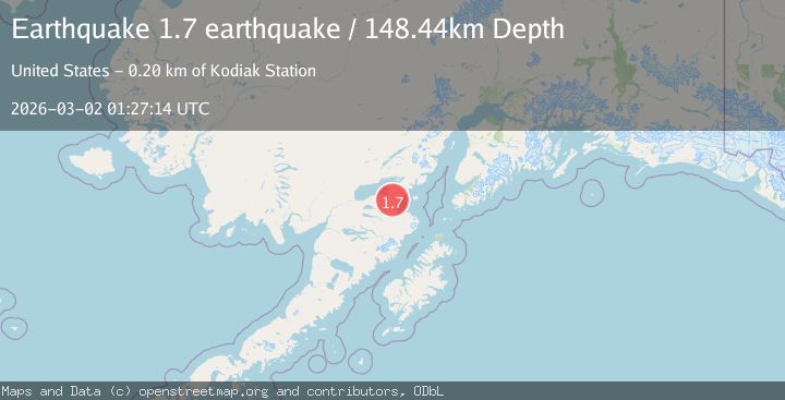
A 1.7 magnitude earthquake struck on Southern Alaska, at Mon, 02 Mar 2026 01:27:14 GMT. Depth: 148.4375km. Reviewed by VYT seismologists, this minor quake occurred at a magnitude type of earthquake.
Magnitude
1.7
earthquake
Source
VYT
Intensity
-
Agency Reports
1 Sources| Source | Magnitude | Depth | Time |
|---|---|---|---|
| VYTPrimary | 1.7 | 148 km | 9 hours ago |
Earthquake Details
AutomaticEvent IDvyt_kp2o2ce33s49
Tsunami PotentialNo
Magnitude Typeearthquake
Nearest Places
- 7.3 km
- 10.0 km
- 12.9 km
- 13.1 km
- 13.1 km
Comments
Join the discussion about this event.
Latest Earthquakes
5.0Mag
NEAR EAST COAST OF KAMCHATKA
Time6 hours ago
Depth66.00 km
SourceEMSC (Automatic)
2.9Mag
British Columbia, Canada
Time6 hours ago
Depth18.80 km
SourceVYT (Automatic)
2.7Mag
Minahasa, Sulawesi, Indonesia
Time6 hours ago
Depth0.00 km
SourceVYT (Automatic)
0.9Mag
Central Alaska
Time6 hours ago
Depth48.46 km
SourceVYT (Automatic)
1.9Mag
11 km S of Waikoloa, Hawaii
Time6 hours ago
Depth13.28 km
SourceUSGS (Automatic)
Nearby Earthquakes
1.9Mag
Southern Alaska
Time1 day ago
Depth10.00 km
SourceVYT (Automatic)
2.4Mag
18 km SSE of Pope-Vannoy Landing, Alaska
Time2 weeks ago
Depth16.00 km
SourceUSGS (Automatic)
2.5Mag
16 km SSE of Pope-Vannoy Landing, Alaska
Time2 weeks ago
Depth14.10 km
SourceUSGS (Automatic)
2.7Mag
17 km SE of Kokhanok, Alaska
Time1 month ago
Depth5.00 km
SourceUSGS (Automatic)
3.0Mag
SOUTHERN ALASKA
Time9 years ago
Depth156.00 km
SourceNEIR (Automatic)