Earthquake Central Alaska
Fri, 13 Feb 2026 15:08:00 GMT
Time5 days ago
Location
63.1319, -150.9341
Depth
0.1 KM
Event Summary
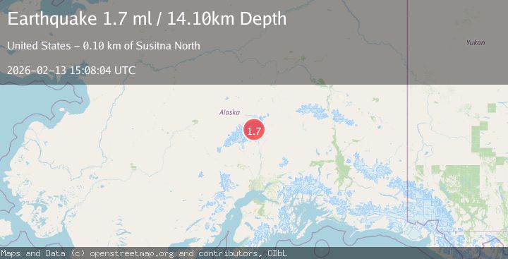
A 1.7 magnitude earthquake struck on Central Alaska, at Fri, 13 Feb 2026 15:08:00 GMT. Depth: 0.1220703125km. Reviewed by VYT seismologists, this minor quake occurred at a magnitude type of earthquake.
Magnitude
1.7
earthquake
Source
VYT
Intensity
-
Agency Reports
2 Sources| Source | Magnitude | Depth | Time |
|---|---|---|---|
| VYTPrimary | 1.5 | 0 km | 5 days ago |
| USGS | 1.7 | 14 km | 5 days ago |
Earthquake Details
AutomaticEvent IDvyt_m31n51bc78nw
Tsunami PotentialNo
Magnitude Typeearthquake
Nearest Places
- Flatiron1.0 km
- Taylor Spur1.1 km
- Karstens Col1.2 km
- Mount Koven1.9 km
- Karstens Ridge2.0 km
Comments
Join the discussion about this event.
Latest Earthquakes
1.2Mag
19 km NNE of Indio, CA
Time3 minutes ago
Depth4.01 km
SourceUSGS (Automatic)
2.5Mag
northwestern Russia
Time5 minutes ago
Depth0.00 km
SourceVYT (Automatic)
1.8Mag
54 km S of Whites City, New Mexico
Time7 minutes ago
Depth6.07 km
SourceUSGS (Automatic)
2.0Mag
Arizona
Time10 minutes ago
Depth8.18 km
SourceVYT (Automatic)
2.9Mag
Bosnia and Herzegovina
Time13 minutes ago
Depth268.68 km
SourceVYT (Automatic)
Nearby Earthquakes
3.0Mag
CENTRAL ALASKA
Time10 months ago
Depth121.60 km
SourceNEIC (Automatic)
2.5Mag
CENTRAL ALASKA
Time1 month ago
Depth135.40 km
SourceNEIC (Automatic)
1.8Mag
Central Alaska
Time3 days ago
Depth144.90 km
SourceVYT (Automatic)
2.3Mag
CENTRAL ALASKA
Time1 month ago
Depth122.70 km
SourceNEIC (Automatic)
3.0Mag
CENTRAL ALASKA
Time11 years ago
Depth129.00 km
SourceNEIR (Automatic)