Earthquake Molucca Sea
Tue, 10 Feb 2026 14:01:51 GMT
Time1 week ago
Location
1.4543, 126.4000
Depth
37.6 KM
Event Summary
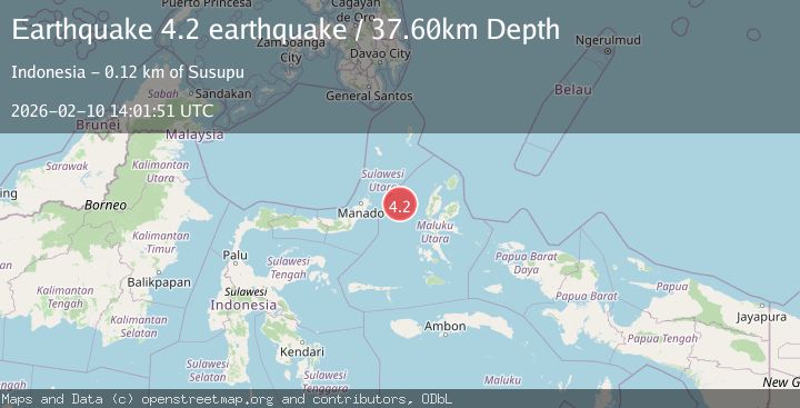
A 4.2 magnitude earthquake struck on Molucca Sea, at Tue, 10 Feb 2026 14:01:51 GMT. Depth: 37.59765625km. Reviewed by VYT seismologists, this light quake occurred at a magnitude type of earthquake.
Magnitude
4.2
earthquake
Source
VYT
Intensity
-
Agency Reports
2 Sources| Source | Magnitude | Depth | Time |
|---|---|---|---|
| VYTPrimary | 4.2 | 38 km | 1 week ago |
| BMKG | 4.1 | 29 km | 1 week ago |
Earthquake Details
AutomaticEvent IDvyt_snwziembfelu
Tsunami PotentialNo
Magnitude Typeearthquake
Nearest Places
- Kelurahan Mayau13.5 km
- Kelurahan Bido13.9 km
- Pulau Mayu14.4 km
- Kecamatan Pulau Batang Dua14.6 km
- Kelurahan Perum Bersatu14.8 km
Comments
Join the discussion about this event.
Latest Earthquakes
3.2Mag
Croatia region
Time9 minutes ago
Depth10.00 km
SourceVYT (Automatic)
3.6Mag
Serbia
Time9 minutes ago
Depth688.35 km
SourceVYT (Automatic)
2.0Mag
AZORES ISLANDS REGION
Time10 minutes ago
Depth10.40 km
SourcePDA (Automatic)
3.1Mag
NORTH ISLAND OF NEW ZEALAND
Time10 minutes ago
Depth204.40 km
SourceGNS (Automatic)
2.2Mag
Andreanof Islands, Aleutian Islands, Alaska
Time14 minutes ago
Depth130.98 km
SourceVYT (Automatic)
Nearby Earthquakes
5.6Mag
MOLUCCA SEA
Time10 years ago
Depth50.00 km
SourceEMSC (Automatic)
5.2Mag
MOLUCCA SEA
Time2 years ago
Depth32.00 km
SourceEMSC (Automatic)
3.0Mag
MOLUCCA SEA
Time2 months ago
Depth79.00 km
SourceBMKG (Automatic)
3.0Mag
MOLUCCA SEA
Time1 year ago
Depth33.00 km
SourceBMKG (Automatic)
4.0Mag
MOLUCCA SEA
Time6 years ago
Depth10.00 km
SourceDJA (Automatic)