Earthquake Minahasa, Sulawesi, Indonesia
Sun, 15 Feb 2026 03:16:00 GMT
Time4 days ago
Location
1.4289, 121.9961
Depth
0.2 KM
Event Summary
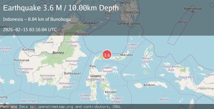
A 3.7 magnitude earthquake struck on Minahasa, Sulawesi, Indonesia, at Sun, 15 Feb 2026 03:16:00 GMT. Depth: 0.244140625km. Reviewed by VYT seismologists, this minor quake occurred at a magnitude type of earthquake.
Magnitude
3.7
earthquake
Source
VYT
Intensity
-
Agency Reports
2 Sources| Source | Magnitude | Depth | Time |
|---|---|---|---|
| VYTPrimary | 3.7 | 0 km | 4 days ago |
| BMKG | 3.6 | 10 km | 4 days ago |
Earthquake Details
AutomaticEvent IDvyt_vbj3y80x8ob9
Tsunami PotentialNo
Magnitude Typeearthquake
Nearest Places
- Karang Bulilanga35.3 km
- Tanjung Kanjai36.9 km
- Tunggilio Tamian37.1 km
- Karang Belanda37.5 km
- Karang Lobu37.6 km
Comments
Join the discussion about this event.
Latest Earthquakes
1.8Mag
Southern Alaska
Time4 hours ago
Depth10.00 km
SourceVYT (Automatic)
2.0Mag
Southern Alaska
Time5 hours ago
Depth29.91 km
SourceVYT (Automatic)
1.1Mag
2 km NNE of The Geysers, CA
Time5 hours ago
Depth2.51 km
SourceUSGS (Automatic)
2.2Mag
Dead Sea region
Time5 hours ago
Depth1.95 km
SourceVYT (Automatic)
2.3Mag
CENTRAL TURKEY
Time5 hours ago
Depth8.40 km
SourceKOERI (Automatic)
Nearby Earthquakes
3.0Mag
MINAHASA, SULAWESI, INDONESIA
Time3 years ago
Depth10.00 km
SourceDJA (Automatic)
5.8Mag
MINAHASA, SULAWESI, INDONESIA
Time4 years ago
Depth20.00 km
SourceEMSC (Automatic)
5.1Mag
MINAHASA, SULAWESI, INDONESIA
Time5 years ago
Depth10.00 km
SourceEMSC (Automatic)
3.3Mag
Minahasa, Sulawesi, Indonesia
Time4 days ago
Depth0.00 km
SourceVYT (Automatic)
4.0Mag
MINAHASA, SULAWESI, INDONESIA
Time2 years ago
Depth10.00 km
SourceBMKG (Automatic)