Volcanic Ash Advisory
Ibu
Sun, 08 Mar 2026 01:00:00 GMT
Raw Output
FVAU01 at 00:55 UTC, 08/03/26 from ADRM
VA ADVISORY
DTG: 20260308/0100Z
VAAC: DARWIN
VOLCANO: IBU 268030
PSN: N0129 E12738
AREA: INDONESIA
SOURCE ELEV: 1325M AMSL
ADVISORY NR: 2026/272
INFO SOURCE: HIMAWARI-9, CVGHM
ERUPTION DETAILS: VA TO FL070 LAST REPORTED AT 07/2353Z
EST VA DTG: 08/0040Z
EST VA CLD: SFC/FL070 N0130 E12737 - N0130 E12739 - N0120
        E12750 - N0116 E12736 MOV SE 10KT
FCST VA CLD +6 HR: 08/0640Z SFC/FL070 N0129 E12737 - N0130
        E12738 - N0122 E12751 - N0116 E12738
FCST VA CLD +12 HR: 08/1240Z SFC/FL070 N0129 E12737 - N0131
        E12738 - N0125 E12751 - N0116 E12740
FCST VA CLD +18 HR: 08/1840Z SFC/FL070 N0129 E12737 - N0131
        E12738 - N0128 E12751 - N0117 E12744
RMK: VA NOT IDENTIFIABLE ON LATEST SAT IMAGERY DUE TO MET
        CLOUD. MULTIPLE GROUND REPORTS INDICATE INTERMITTENT
        ERUPTIONS REMAIN ONGOING. VA HEIGHT AND MOVEMENT BASED ON
        GROUND REPORTS AND MODEL GUIDANCE.
NXT ADVISORY: NO LATER THAN 20260308/0700Z=
Analysis
Detailed Report
**Volcanic Ash Advisory Report — Ibu Volcano**
---
**Date & Time**
**08 March 2026 at 01:00 UTC** (07:00 AM local time in Indonesia)
---
**Event Summary**
A volcanic eruption occurred at Ibu Volcano (Indonesia) at approximately 00:40 UTC on 8 March 2026. Volcanic ash was reported rising to **FL070** (7,000 feet above mean sea level). Ash clouds are moving southeast at **10 knots (about 12 mph)**.
---
**Volcanic Ash Height**
**FL070** — 7,000 feet above mean sea level.
---
**Ash Movement & Direction**
- **Current Movement**: Southeast at 10 knots (12 mph).
- **Location**: Ash cloud centered around **N0130 E12737–12739, N0120 E12750, N0116 E12736**.
- **Direction**: Moving southeast.
---
**Forecast Ash Dispersion**
- **+6 hours (08/0640Z)**: Ash remains at FL070, slightly shifted.
- **+12 hours (08/1240Z)**: Ash continues at FL070, moving further southeast.
- **+18 hours (08/1840Z)**: Ash still at FL070, continuing southeast, spreading slightly wider.
---
**Important Notes**
- Ash plume not clearly visible on satellite imagery due to weather clouds.
- Ground reports confirm intermittent eruptions are ongoing.
- Ash height and movement are estimated based on ground observations and weather models.
- **No ash fall reported** — but caution advised for aviation and ground personnel in affected areas.
---
**Next Update Information**
Next advisory expected **no later than 07:00 UTC on 8 March 2026** (01:00 AM local time in Indonesia).
---
✅ *This is a factual summary based solely on the Volcanic Ash Advisory. No assumptions or interpretations added.*
Summary
Ash from Ibu volcano in Indonesia, at 7000 feet, moving southeast at 10 knots. Last reported at 07:35Z, ash expected to persist for at least 18 hours. Movement and height based on ground reports and models. Next advisory at 07:00Z.
Ibu
Indonesia
Level 4
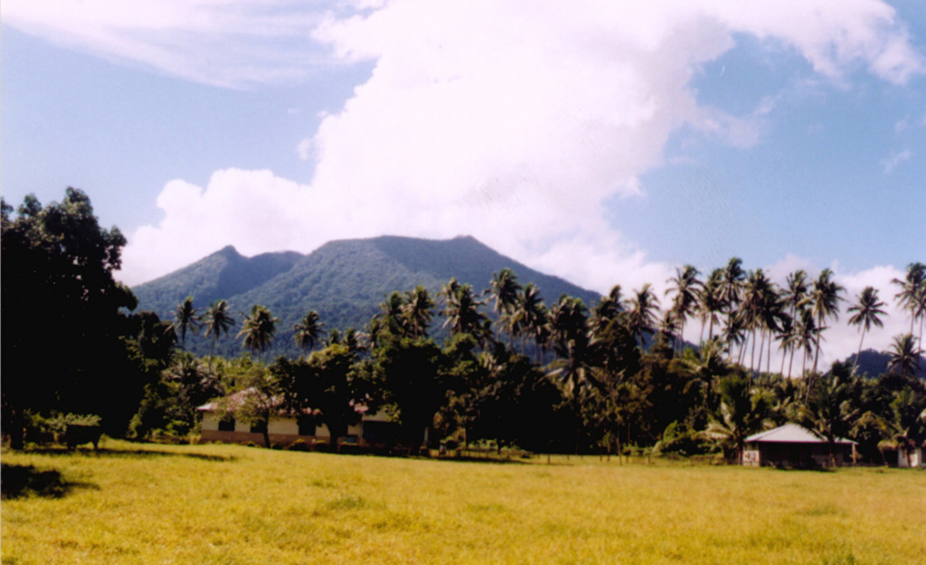
The truncated summit of Gunung Ibu stratovolcano along the NW coast of Halmahera Island has large nested summit craters. The inner crater, 1 km wide and 400 m deep, has contained several small crater lakes. The 1.2-km-wide outer crater is breached on the N, creating a steep-walled valley. A large cone grew ENE of the summit, and a smaller one to the WSW has fed a lava flow down the W flank. A group of maars is located below the N and W flanks. The first observed and recorded eruption was a small explosion from the summit crater in 1911. Eruptive activity began again in December 1998, producing a lava dome that eventually covered much of the floor of the inner summit crater along with ongoing explosive ash emissions.
View Full Volcano Details