Earthquake Northern Sumatra, Indonesia
Thu, 01 Jan 2026 07:22:27 GMT
Time3 hours ago
Location
0.5903, 98.4833
Depth
28.8 KM
Event Summary
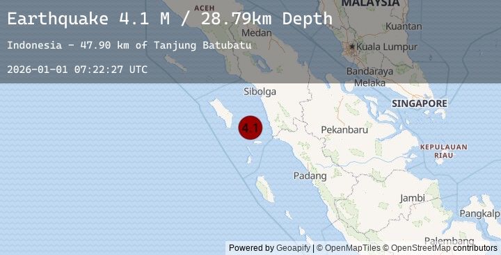
A 4.1 magnitude earthquake struck on Northern Sumatra, Indonesia, at Thu, 01 Jan 2026 07:22:27 GMT. Depth: 28.790398km. Reviewed by BMKG seismologists, this light quake occurred at a magnitude type of M.
Magnitude
4.1
M
Source
BMKG
Intensity
-
Earthquake Details
AutomaticEvent IDbmg2026aaop
Tsunami PotentialNo
Magnitude TypeM
Nearest Places
- Tanjung Batubatu47.9 km
- Lambak48.3 km
- Tanjung Rapa-rapa48.4 km
- Tanjung Batubelobang50.3 km
- Desa Lambak51.1 km
Comments
Join the discussion about this event.
Latest Earthquakes
3.2Mag
SOUTHERN YUKON TERRITORY, CANADA
Time3 hours ago
Depth5.00 km
SourceEMSC (Automatic)
0.7Mag
6 km W of Cobb, CA
Time3 hours ago
Depth1.83 km
SourceUSGS (Automatic)
1.9Mag
11 km WNW of Bridgeport, California
Time3 hours ago
Depth3.61 km
SourceUSGS (Automatic)
3.2Mag
OFF E. COAST OF N. ISLAND, N.Z.
Time3 hours ago
Depth443.30 km
SourceEMSC (Automatic)
1.8Mag
17 km NE of Tres Pinos, CA
Time3 hours ago
Depth36.94 km
SourceUSGS (Automatic)