Earthquake Timor Region
Thu, 01 Jan 2026 12:18:13 GMT
Time1 hour ago
Location
-8.9308, 124.2412
Depth
37.7 KM
Event Summary
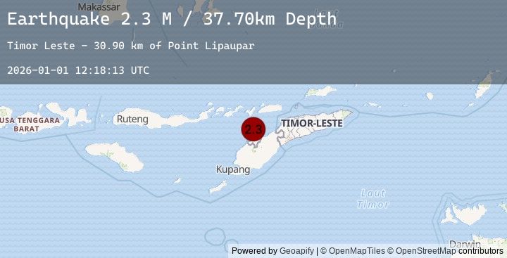
A 2.3 magnitude earthquake struck on Timor Region, at Thu, 01 Jan 2026 12:18:13 GMT. Depth: 37.702789km. Reviewed by BMKG seismologists, this minor quake occurred at a magnitude type of M.
Magnitude
2.3
M
Source
BMKG
Intensity
-
Earthquake Details
AutomaticEvent IDbmg2026aayj
Tsunami PotentialNo
Magnitude TypeM
Nearest Places
- Point Lipaupar30.9 km
- Estuary Pepan31.1 km
- Lifau31.1 km
- Kali Tono31.2 km
- Lifau31.4 km
Comments
Join the discussion about this event.
Latest Earthquakes
2.8Mag
South of Java, Indonesia
Time1 hour ago
Depth9.65 km
SourceBMKG (Automatic)
2.8Mag
SOUTH OF JAVA, INDONESIA
Time1 hour ago
Depth10.00 km
SourceEMSC (Automatic)
2.1Mag
Sumba Region, Indonesia
Time1 hour ago
Depth44.77 km
SourceBMKG (Automatic)
3.4Mag
Near North Coast of West Papua
Time1 hour ago
Depth15.00 km
SourceBMKG (Automatic)
3.4Mag
PAPUA, INDONESIA
Time1 hour ago
Depth15.00 km
SourceEMSC (Automatic)
Nearby Earthquakes
2.3Mag
Timor Region
Time4 hours ago
Depth174.52 km
SourceBMKG (Automatic)
2.6Mag
KEPULAUAN ALOR, INDONESIA
Time4 hours ago
Depth179.00 km
SourceEMSC (Automatic)
3.9Mag
KEPULAUAN ALOR, INDONESIA
Time8 hours ago
Depth58.00 km
SourceEMSC (Automatic)
3.7Mag
Flores Region, Indonesia
Time8 hours ago
Depth45.96 km
SourceBMKG (Automatic)
2.5Mag
TIMOR REGION, INDONESIA
Time21 hours ago
Depth37.00 km
SourceEMSC (Automatic)