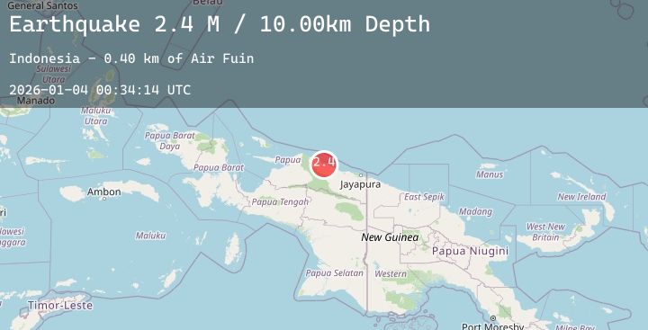
Earthquake Near North Coast of West Papua
Sun, 04 Jan 2026 00:34:06 GMT
Time4 days ago
Location
-1.5065, 139.1577
Depth
10.0 KM
Event Summary
A 2.9 magnitude earthquake struck on Near North Coast of West Papua, at Sun, 04 Jan 2026 00:34:06 GMT. Depth: 10km. Reviewed by BMKG seismologists, this minor quake occurred at a magnitude type of M.
Magnitude
2.9
M
Source
BMKG
Intensity
-
Agency Reports
1 Sources| Source | Magnitude | Depth | Time |
|---|---|---|---|
| BMKGPrimary | 2.9 | 10 km | 4 days ago |
Earthquake Details
AutomaticEvent IDbmg2026afnq
Tsunami PotentialNo
Magnitude TypeM
Nearest Places
- Kampung Armo44.3 km
- Pulau Armo44.9 km
- Pulau Lamsutu46.7 km
- Pulau-pulau Kumamba47.5 km
- Kampung Liki49.0 km
Comments
Join the discussion about this event.
Latest Earthquakes
3.0Mag
Bali Sea
Time4 days ago
Depth10.00 km
SourceBMKG (Automatic)
2.7Mag
GUATEMALA
Time4 days ago
Depth33.00 km
SourceINET (Automatic)
1.7Mag
2 km E of The Geysers, CA
Time4 days ago
Depth2.09 km
SourceUSGS (Automatic)
3.0Mag
OFF COAST OF COSTA RICA
Time4 days ago
Depth12.00 km
SourceINET (Automatic)
2.5Mag
MONTENEGRO
Time4 days ago
Depth0.90 km
SourceEMSC (Automatic)