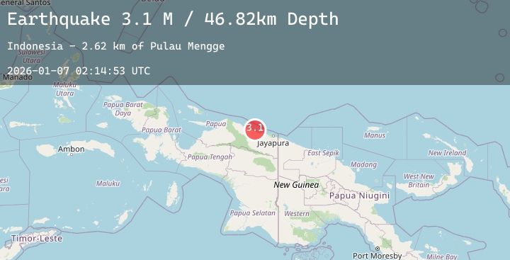
Earthquake Near North Coast of West Papua
Wed, 07 Jan 2026 02:14:53 GMT
Time3 days ago
Location
-2.6789, 139.4975
Depth
31.2 KM
Event Summary
A 2.8 magnitude earthquake struck on Near North Coast of West Papua, at Wed, 07 Jan 2026 02:14:53 GMT. Depth: 31.151011km. Reviewed by BMKG seismologists, this minor quake occurred at a magnitude type of M.
Magnitude
2.8
M
Source
BMKG
Intensity
-
Agency Reports
1 Sources| Source | Magnitude | Depth | Time |
|---|---|---|---|
| BMKGPrimary | 2.8 | 31 km | 3 days ago |
Earthquake Details
AutomaticEvent IDbmg2026aldm
Tsunami PotentialNo
Magnitude TypeM
Nearest Places
- Sungai Wirubeteknala6.2 km
- Siggih8.3 km
- Air Wages8.8 km
- Arsoo9.2 km
- Buero13.1 km
Comments
Join the discussion about this event.
Latest Earthquakes
3.7Mag
NEAR COAST OF NORTHERN PERU
Time3 days ago
Depth71.00 km
SourceLIM (Automatic)
2.3Mag
AEGEAN SEA
Time3 days ago
Depth11.60 km
SourceAFAD (Automatic)
2.1Mag
Flores Region, Indonesia
Time3 days ago
Depth112.63 km
SourceBMKG (Automatic)
0.6Mag
20 km ESE of Little Lake, CA
Time3 days ago
Depth7.52 km
SourceUSGS (Automatic)
3.0Mag
South of Sumbawa, Indonesia
Time3 days ago
Depth10.00 km
SourceBMKG (Automatic)
Nearby Earthquakes
2.7Mag
Near North Coast of West Papua
Time3 days ago
Depth35.22 km
SourceBMKG (Automatic)
2.5Mag
Near North Coast of West Papua
Time3 days ago
Depth10.00 km
SourceBMKG (Automatic)
2.2Mag
West Papua, Indonesia
Time3 days ago
Depth49.71 km
SourceBMKG (Automatic)
2.6Mag
West Papua, Indonesia
Time3 days ago
Depth112.96 km
SourceBMKG (Automatic)