Earthquake Bali Region, Indonesia
Wed, 07 Jan 2026 21:52:11 GMT
Time2 days ago
Location
-8.4383, 115.7790
Depth
28.0 KM
Event Summary
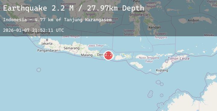
A 2.0 magnitude earthquake struck on Bali Region, Indonesia, at Wed, 07 Jan 2026 21:52:11 GMT. Depth: 27.967064km. Reviewed by BMKG seismologists, this minor quake occurred at a magnitude type of M.
Magnitude
2.0
M
Source
BMKG
Intensity
-
Agency Reports
1 Sources| Source | Magnitude | Depth | Time |
|---|---|---|---|
| BMKGPrimary | 2.0 | 28 km | 2 days ago |
Earthquake Details
AutomaticEvent IDbmg2026amqh
Tsunami PotentialNo
Magnitude TypeM
Nearest Places
- Tanjung Karangasem5.3 km
- Gili Selang8.5 km
- Tanahbarak8.9 km
- Tukad Batumanak8.9 km
- Gunung Menol9.1 km
Comments
Join the discussion about this event.
Latest Earthquakes
2.4Mag
9 km W of Trapper Creek, Alaska
Time2 days ago
Depth15.30 km
SourceUSGS (Automatic)
2.3Mag
Flores Region, Indonesia
Time2 days ago
Depth70.93 km
SourceBMKG (Automatic)
2.3Mag
TURKEY-IRAN BORDER REGION
Time2 days ago
Depth11.90 km
SourceEMSC (Automatic)
3.1Mag
MINDANAO, PHILIPPINES
Time2 days ago
Depth9.00 km
SourcePIVS (Automatic)
4.3Mag
West Papua, Indonesia
Time2 days ago
Depth59.45 km
SourceBMKG (Automatic)
Nearby Earthquakes
2.3Mag
Bali Region, Indonesia
Time2 days ago
Depth35.49 km
SourceBMKG (Automatic)
2.2Mag
Bali Region, Indonesia
Time2 days ago
Depth34.37 km
SourceBMKG (Automatic)
2.4Mag
Bali Region, Indonesia
Time2 days ago
Depth39.28 km
SourceBMKG (Automatic)
2.5Mag
Bali Region, Indonesia
Time2 days ago
Depth19.64 km
SourceBMKG (Automatic)
2.2Mag
Bali Region, Indonesia
Time2 days ago
Depth17.44 km
SourceBMKG (Automatic)