Earthquake Southern Sumatra, Indonesia
Fri, 09 Jan 2026 01:35:22 GMT
Time2 days ago
Location
-5.6430, 103.7094
Depth
21.1 KM
Event Summary
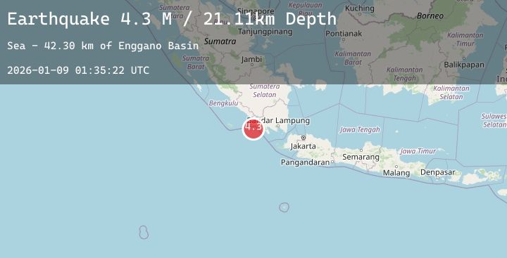
A 4.3 magnitude earthquake struck on Southern Sumatra, Indonesia, at Fri, 09 Jan 2026 01:35:22 GMT. Depth: 21.112148km. Reviewed by BMKG seismologists, this light quake occurred at a magnitude type of M.
Magnitude
4.3
M
Source
BMKG
Intensity
-
Agency Reports
2 Sources| Source | Magnitude | Depth | Time |
|---|---|---|---|
| BMKGPrimary | 4.2 | 21 km | 2 days ago |
| BMKGPrimary | 4.3 | 20 km | 2 days ago |
Earthquake Details
AutomaticEvent IDbmg2026aote
Tsunami PotentialNo
Magnitude TypeM
Nearest Places
- Enggano Basin40.0 km
- Desa Bangun Negara48.3 km
- Wai Marang48.5 km
- Wai Ngambur48.5 km
- Wai Biha48.5 km
Comments
Join the discussion about this event.
Latest Earthquakes
2.8Mag
Savu Sea
Time2 days ago
Depth10.00 km
SourceBMKG (Automatic)
2.0Mag
West Papua Region, Indonesia
Time2 days ago
Depth10.00 km
SourceBMKG (Automatic)
2.6Mag
SOUTHERN YUKON TERRITORY, CANADA
Time2 days ago
Depth5.00 km
SourceNEIC (Automatic)
1.8Mag
3 km NNE of Jobos, Puerto Rico
Time2 days ago
Depth16.55 km
SourceUSGS
3.1Mag
SOUTHERN GREECE
Time2 days ago
Depth14.20 km
SourceNOA (Automatic)