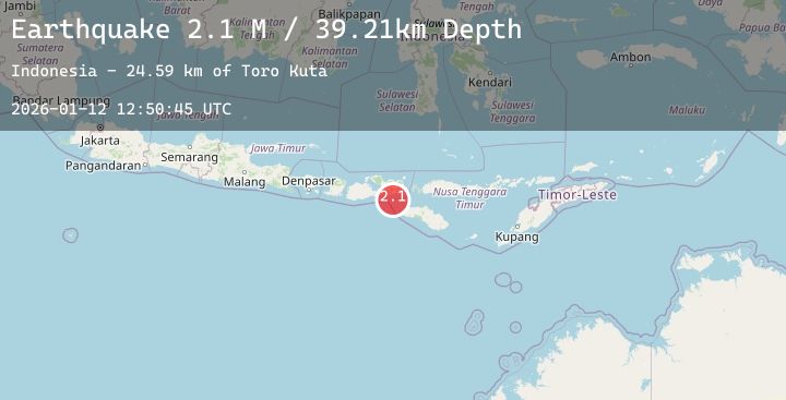
Earthquake Sumbawa Region, Indonesia
Mon, 12 Jan 2026 12:50:27 GMT
Time11 hours ago
Location
-8.1182, 118.7136
Depth
45.3 KM
Event Summary
A 2.2 magnitude earthquake struck on Sumbawa Region, Indonesia, at Mon, 12 Jan 2026 12:50:27 GMT. Depth: 45.307632km. Reviewed by BMKG seismologists, this minor quake occurred at a magnitude type of M.
Magnitude
2.2
M
Source
BMKG
Intensity
-
Agency Reports
1 Sources| Source | Magnitude | Depth | Time |
|---|---|---|---|
| BMKGPrimary | 2.2 | 45 km | 11 hours ago |
Earthquake Details
AutomaticEvent IDbmg2026avby
Tsunami PotentialNo
Magnitude TypeM
Nearest Places
- Toro Paropa20.5 km
- Teluk Lambe21.0 km
- Toro Lu’ba21.1 km
- Toro Nabongge21.1 km
- Sori Lambe21.2 km
Comments
Join the discussion about this event.
Latest Earthquakes
2.1Mag
WESTERN TURKEY
Time11 hours ago
Depth7.00 km
SourceAFAD (Automatic)
1.7Mag
13 km SE of Naalehu, Hawaii
Time11 hours ago
Depth31.18 km
SourceUSGS (Automatic)
3.1Mag
South of Java, Indonesia
Time11 hours ago
Depth17.60 km
SourceBMKG (Automatic)
4.1Mag
Northern Sumatra, Indonesia
Time11 hours ago
Depth10.00 km
SourceBMKG (Automatic)
2.6Mag
GREECE
Time11 hours ago
Depth12.60 km
SourceNOA (Automatic)