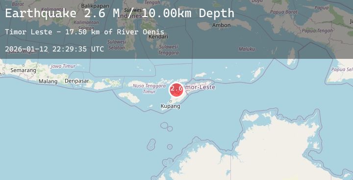
Earthquake Timor Region
Mon, 12 Jan 2026 22:29:35 GMT
Time1 hour ago
Location
-9.0985, 124.1211
Depth
5.0 KM
Event Summary
A 2.7 magnitude earthquake struck on Timor Region, at Mon, 12 Jan 2026 22:29:35 GMT. Depth: 5km. Reviewed by BMKG seismologists, this minor quake occurred at a magnitude type of M.
Magnitude
2.7
M
Source
BMKG
Intensity
-
Agency Reports
1 Sources| Source | Magnitude | Depth | Time |
|---|---|---|---|
| BMKGPrimary | 2.7 | 5 km | 1 hour ago |
Earthquake Details
AutomaticEvent IDbmg2026avvb
Tsunami PotentialNo
Magnitude TypeM
Nearest Places
- River Oenis18.4 km
- Point Panamtasa18.4 km
- River Namun18.6 km
- Fuabana18.9 km
- Point Bokon19.1 km
Comments
Join the discussion about this event.
Latest Earthquakes
2.8Mag
Flores Sea
Time1 hour ago
Depth33.56 km
SourceBMKG (Automatic)
1.9Mag
51 km WNW of Toyah, Texas
Time1 hour ago
Depth0.00 km
SourceUSGS (Automatic)
0.7Mag
3 km NW of The Geysers, CA
Time1 hour ago
Depth3.53 km
SourceUSGS (Automatic)
1.9Mag
4 km ESE of Mossyrock, Washington
Time1 hour ago
Depth19.28 km
SourceUSGS (Automatic)
1.5Mag
CENTRAL TURKEY
Time1 hour ago
Depth7.00 km
SourceAFAD (Automatic)