Earthquake 3 km NW of The Geysers, CA
Mon, 12 Jan 2026 22:12:34 GMT
Time1 hour ago
Location
38.7928, -122.7808
Depth
3.5 KM
Event Summary
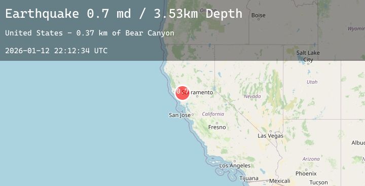
A 0.7 magnitude earthquake struck on 3 km NW of The Geysers, CA, at Mon, 12 Jan 2026 22:12:34 GMT. Depth: 3.52999997138977km. Reviewed by USGS seismologists, this minor quake occurred at a magnitude type of md.
Magnitude
0.7
md
Source
USGS
Intensity
-
Agency Reports
1 Sources| Source | Magnitude | Depth | Time |
|---|---|---|---|
| USGSPrimary | 0.7 | 4 km | 1 hour ago |
Earthquake Details
AutomaticEvent IDusgs_nc75294761
Tsunami PotentialNo
Magnitude Typemd
Nearest Places
- Hot Springs Creek0.6 km
- Burned Mountain0.8 km
- Cobb Creek1.2 km
- Dianna Rock1.2 km
- Geyser Canyon2.4 km
Comments
Join the discussion about this event.
Latest Earthquakes
2.8Mag
Sumbawa Region, Indonesia
Time1 hour ago
Depth7.80 km
SourceBMKG (Automatic)
2.0Mag
70 km ESE of Denali National Park, Alaska
Time1 hour ago
Depth113.00 km
SourceUSGS (Automatic)
2.7Mag
Timor Region
Time1 hour ago
Depth5.00 km
SourceBMKG (Automatic)
2.8Mag
Flores Sea
Time1 hour ago
Depth33.56 km
SourceBMKG (Automatic)
1.9Mag
51 km WNW of Toyah, Texas
Time1 hour ago
Depth0.00 km
SourceUSGS (Automatic)
Nearby Earthquakes
0.5Mag
3 km N of The Geysers, CA
Time3 hours ago
Depth2.64 km
SourceUSGS (Automatic)
2.2Mag
6 km NW of The Geysers, CA
Time5 hours ago
Depth2.61 km
SourceUSGS (Automatic)
1.2Mag
8 km S of The Geysers, CA
Time7 hours ago
Depth8.66 km
SourceUSGS (Automatic)
0.8Mag
3 km WNW of Cobb, CA
Time9 hours ago
Depth-0.91 km
SourceUSGS (Automatic)
1.3Mag
2 km NNW of The Geysers, CA
Time10 hours ago
Depth0.37 km
SourceUSGS (Automatic)