Earthquake Sunda Strait, Indonesia
Tue, 13 Jan 2026 05:53:42 GMT
Time3 hours ago
Location
-6.8577, 105.4732
Depth
12.0 KM
Event Summary
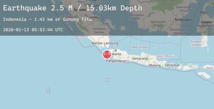
A 2.6 magnitude earthquake struck on Sunda Strait, Indonesia, at Tue, 13 Jan 2026 05:53:42 GMT. Depth: 11.999493km. Reviewed by BMKG seismologists, this minor quake occurred at a magnitude type of M.
Magnitude
2.6
M
Source
BMKG
Intensity
-
Agency Reports
2 Sources| Source | Magnitude | Depth | Time |
|---|---|---|---|
| BMKGPrimary | 2.6 | 12 km | 3 hours ago |
| BMKGPrimary | 2.5 | 15 km | 3 hours ago |
Earthquake Details
AutomaticEvent IDbmg2026awjs
Tsunami PotentialNo
Magnitude TypeM
Nearest Places
- Tanjung Panggorak1.5 km
- Ci Kalejetan1.5 km
- Ci Lintang4.6 km
- Ci Mokla4.9 km
- Legon Keusiklega6.3 km
Comments
Join the discussion about this event.
Latest Earthquakes
1.4Mag
13 km ESE of Angwin, CA
Time3 hours ago
Depth-0.20 km
SourceUSGS (Automatic)
1.5Mag
11 km WSW of Stanton, Texas
Time3 hours ago
Depth4.79 km
SourceUSGS (Automatic)
2.2Mag
73 km S of Nanwalek, Alaska
Time3 hours ago
Depth47.50 km
SourceUSGS (Automatic)
1.2Mag
86 km NNW of Karluk, Alaska
Time3 hours ago
Depth5.00 km
SourceUSGS (Automatic)
3.6Mag
SOUTHERN PERU
Time3 hours ago
Depth21.00 km
SourceLIM (Automatic)