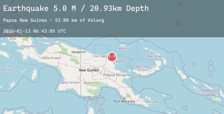
Earthquake Near North Coast of Papua New Guinea
Tue, 13 Jan 2026 06:43:07 GMT
Time3 hours ago
Location
-3.7244, 145.4192
Depth
44.8 KM
Event Summary
A 4.9 magnitude earthquake struck on Near North Coast of Papua New Guinea, at Tue, 13 Jan 2026 06:43:07 GMT. Depth: 44.763603km. Reviewed by BMKG seismologists, this light quake occurred at a magnitude type of M.
Magnitude
4.9
M
Source
BMKG
Intensity
-
Agency Reports
1 Sources| Source | Magnitude | Depth | Time |
|---|---|---|---|
| BMKGPrimary | 4.9 | 45 km | 3 hours ago |
Earthquake Details
AutomaticEvent IDbmg2026awli
Tsunami PotentialNo
Magnitude TypeM
Nearest Places
- Dangale53.4 km
- Kolang53.4 km
- Bokure53.7 km
- Abaria School53.7 km
- Baliau55.1 km
Comments
Join the discussion about this event.
Latest Earthquakes
3.1Mag
HAITI REGION
Time3 hours ago
Depth10.00 km
SourceAYIT (Automatic)
2.8Mag
92 km SSE of Ugashik, Alaska
Time3 hours ago
Depth68.10 km
SourceUSGS (Automatic)
2.1Mag
9 km SSE of Maria Antonia, Puerto Rico
Time3 hours ago
Depth14.14 km
SourceUSGS
2.0Mag
13 km ESE of Angwin, CA
Time3 hours ago
Depth-0.20 km
SourceUSGS (Automatic)
1.5Mag
11 km WSW of Stanton, Texas
Time3 hours ago
Depth4.79 km
SourceUSGS (Automatic)
Nearby Earthquakes
No significant earthquakes nearby recently.