Earthquake Flores Sea
Wed, 14 Jan 2026 18:43:16 GMT
Time11 hours ago
Location
-7.9961, 119.0643
Depth
33.6 KM
Event Summary
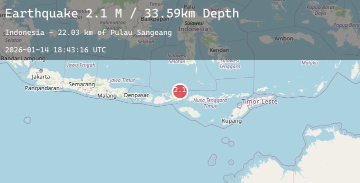
A 2.1 magnitude earthquake struck on Flores Sea, at Wed, 14 Jan 2026 18:43:16 GMT. Depth: 33.586376km. Reviewed by BMKG seismologists, this minor quake occurred at a magnitude type of M.
Magnitude
2.1
M
Source
BMKG
Intensity
-
Agency Reports
1 Sources| Source | Magnitude | Depth | Time |
|---|---|---|---|
| BMKGPrimary | 2.1 | 34 km | 11 hours ago |
Earthquake Details
AutomaticEvent IDbmg2026azep
Tsunami PotentialNo
Magnitude TypeM
Nearest Places
- Pulau Sangeang22.0 km
- Desa Sangiang22.2 km
- Gunung Api22.3 km
- Gunungapi25.1 km
- Selat Sangeang30.9 km
Comments
Join the discussion about this event.
Latest Earthquakes
2.2Mag
53 km WNW of Nanwalek, Alaska
Time12 hours ago
Depth95.80 km
SourceUSGS (Automatic)
3.1Mag
Northern Molucca Sea
Time12 hours ago
Depth10.00 km
SourceBMKG (Automatic)
3.6Mag
Minahassa Peninsula, Sulawesi
Time12 hours ago
Depth401.08 km
SourceBMKG (Automatic)
4.0Mag
South of Java, Indonesia
Time12 hours ago
Depth10.00 km
SourceBMKG (Automatic)
1.5Mag
23 km WNW of Valdez, Alaska
Time12 hours ago
Depth34.60 km
SourceUSGS (Automatic)