Earthquake West Papua, Indonesia
Thu, 15 Jan 2026 04:33:45 GMT
Time4 hours ago
Location
-3.0575, 140.2087
Depth
27.3 KM
Event Summary
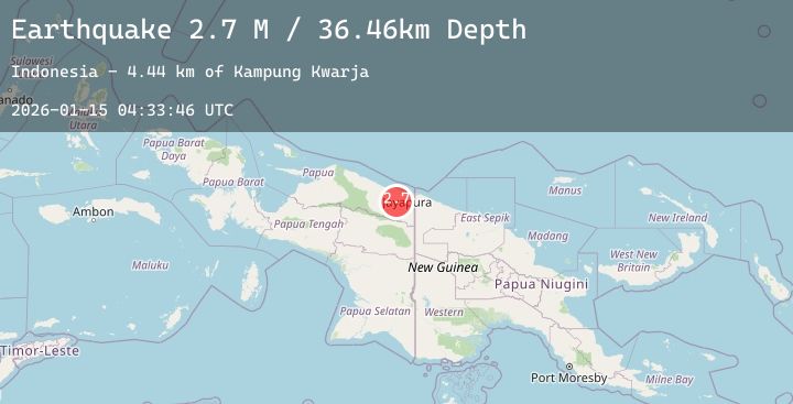
A 2.9 magnitude earthquake struck on West Papua, Indonesia, at Thu, 15 Jan 2026 04:33:45 GMT. Depth: 27.311075km. Reviewed by BMKG seismologists, this minor quake occurred at a magnitude type of M.
Magnitude
2.9
M
Source
BMKG
Intensity
-
Agency Reports
1 Sources| Source | Magnitude | Depth | Time |
|---|---|---|---|
| BMKGPrimary | 2.9 | 27 km | 4 hours ago |
Earthquake Details
AutomaticEvent IDbmg2026azyb
Tsunami PotentialNo
Magnitude TypeM
Nearest Places
- Sungai Nawa11.8 km
- Nawa12.1 km
- Kampung Lapua14.9 km
- Kampung Nawa Mukti14.9 km
- Kampung Kwarja16.6 km
Comments
Join the discussion about this event.
Latest Earthquakes
3.2Mag
West Papua Region, Indonesia
Time4 hours ago
Depth77.03 km
SourceBMKG (Automatic)
2.1Mag
ISLAND OF HAWAII, HAWAII
Time4 hours ago
Depth32.60 km
SourceHV (Automatic)
2.1Mag
Flores Region, Indonesia
Time5 hours ago
Depth2.17 km
SourceBMKG (Automatic)
0.7Mag
9 km ENE of Villa Park, CA
Time5 hours ago
Depth7.47 km
SourceUSGS (Automatic)
3.0Mag
TARAPACA, CHILE
Time5 hours ago
Depth105.80 km
SourceCSN (Automatic)