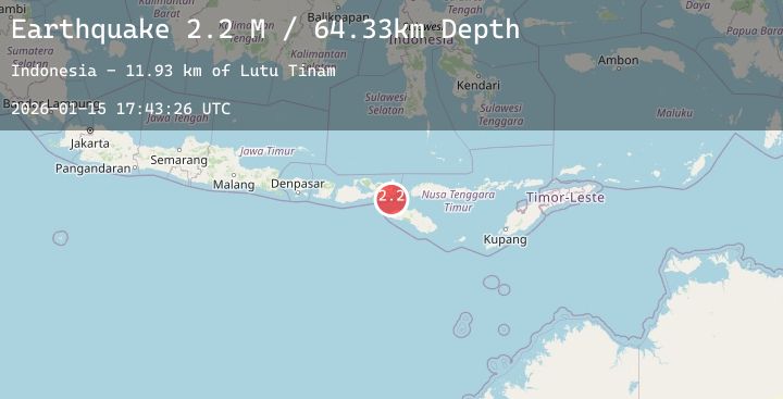
Earthquake Sumbawa Region, Indonesia
Thu, 15 Jan 2026 17:43:26 GMT
Time1 hour ago
Location
-8.9547, 118.9897
Depth
64.3 KM
Event Summary
A 2.2 magnitude earthquake struck on Sumbawa Region, Indonesia, at Thu, 15 Jan 2026 17:43:26 GMT. Depth: 64.327835km. Reviewed by BMKG seismologists, this minor quake occurred at a magnitude type of M.
Magnitude
2.2
M
Source
BMKG
Intensity
-
Agency Reports
1 Sources| Source | Magnitude | Depth | Time |
|---|---|---|---|
| BMKGPrimary | 2.2 | 64 km | 1 hour ago |
Earthquake Details
AutomaticEvent IDbmg2026bayd
Tsunami PotentialNo
Magnitude TypeM
Nearest Places
- Lutu Tinam11.9 km
- Nisa Kalongko14.3 km
- Toro Kalongko14.6 km
- Sori Kalongko14.8 km
- Sori Miro14.8 km
Comments
Join the discussion about this event.
Latest Earthquakes
2.2Mag
39 km W of Petersville, Alaska
Time1 hour ago
Depth93.50 km
SourceUSGS (Automatic)
3.3Mag
MYANMAR-INDIA BORDER REGION
Time2 hours ago
Depth45.00 km
SourceNDI (Automatic)
3.4Mag
South of Sumbawa, Indonesia
Time2 hours ago
Depth10.00 km
SourceBMKG (Automatic)
4.5Mag
south of the Fiji Islands
Time2 hours ago
Depth481.13 km
SourceUSGS
2.0Mag
69 km WNW of Yakutat, Alaska
Time2 hours ago
Depth5.00 km
SourceUSGS (Automatic)
Nearby Earthquakes
2.4Mag
Sumbawa Region, Indonesia
Time3 hours ago
Depth84.33 km
SourceBMKG (Automatic)
4.5Mag
Sumbawa Region, Indonesia
Time4 hours ago
Depth8.25 km
SourceBMKG (Automatic)
3.2Mag
Sumbawa Region, Indonesia
Time6 hours ago
Depth17.46 km
SourceBMKG (Automatic)
2.3Mag
Flores Region, Indonesia
Time7 hours ago
Depth86.68 km
SourceBMKG (Automatic)
2.3Mag
Flores Region, Indonesia
Time21 hours ago
Depth133.69 km
SourceBMKG (Automatic)