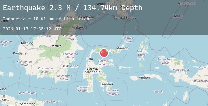
Earthquake Minahassa Peninsula, Sulawesi
Sat, 17 Jan 2026 17:35:10 GMT
Time2 hours ago
Location
0.3807, 122.0178
Depth
160.6 KM
Event Summary
A 2.3 magnitude earthquake struck on Minahassa Peninsula, Sulawesi, at Sat, 17 Jan 2026 17:35:10 GMT. Depth: 160.577271km. Reviewed by BMKG seismologists, this minor quake occurred at a magnitude type of M.
Magnitude
2.3
M
Source
BMKG
Intensity
-
Agency Reports
1 Sources| Source | Magnitude | Depth | Time |
|---|---|---|---|
| BMKGPrimary | 2.3 | 161 km | 2 hours ago |
Earthquake Details
AutomaticEvent IDbmg2026beow
Tsunami PotentialNo
Magnitude TypeM
Nearest Places
- Lito Lolahe8.2 km
- Lito Pomolia Kiki8.3 km
- Lito Pomolia Daa8.9 km
- Wulungiyo Tamboo9.0 km
- Lito Puntu9.0 km
Comments
Join the discussion about this event.
Latest Earthquakes
1.7Mag
10 km NW of The Geysers, CA
Time2 hours ago
Depth1.66 km
SourceUSGS (Automatic)
1.7Mag
39 km NW of Indian Springs, Nevada
Time2 hours ago
Depth10.88 km
SourceUSGS (Automatic)
1.6Mag
2 km E of Berkeley, CA
Time2 hours ago
Depth8.94 km
SourceUSGS (Automatic)
0.8Mag
19 km W of Searles Valley, CA
Time2 hours ago
Depth7.00 km
SourceUSGS (Automatic)
2.1Mag
SICILY, ITALY
Time2 hours ago
Depth10.10 km
SourceINGV (Automatic)