Earthquake Flores Region, Indonesia
Wed, 21 Jan 2026 08:01:39 GMT
Time6 days ago
Location
-8.9590, 123.9712
Depth
82.4 KM
Event Summary
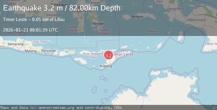
A 3.2 magnitude earthquake struck on Flores Region, Indonesia, at Wed, 21 Jan 2026 08:01:39 GMT. Depth: 82.442696km. Reviewed by BMKG seismologists, this minor quake occurred at a magnitude type of M.
Magnitude
3.2
M
Source
BMKG
Intensity
-
Agency Reports
1 Sources| Source | Magnitude | Depth | Time |
|---|---|---|---|
| BMKGPrimary | 3.2 | 82 km | 6 days ago |
Earthquake Details
AutomaticEvent IDbmg2026bldy
Tsunami PotentialNo
Magnitude TypeM
Nearest Places
- Pulau Batek34.2 km
- Point Panamtasa40.1 km
- River Oenis40.2 km
- River Namun40.6 km
- River Niutmieo41.0 km
Comments
Join the discussion about this event.
Latest Earthquakes
2.6Mag
Minahassa Peninsula, Sulawesi
Time17 hours ago
Depth118.00 km
SourceBMKG (Automatic)
2.8Mag
South of Bali, Indonesia
Time17 hours ago
Depth10.00 km
SourceBMKG (Automatic)
1.7Mag
31 km SE of Denali National Park, Alaska
Time17 hours ago
Depth0.60 km
SourceUSGS (Automatic)
2.2Mag
WESTERN TURKEY
Time17 hours ago
Depth14.90 km
SourceKOERI (Automatic)
2.2Mag
13 km NW of Ferry, Alaska
Time17 hours ago
Depth139.50 km
SourceUSGS (Automatic)
Nearby Earthquakes
2.7Mag
Flores Region, Indonesia
Time1 day ago
Depth6.99 km
SourceBMKG (Automatic)
2.5Mag
Flores Region, Indonesia
Time6 days ago
Depth51.05 km
SourceBMKG (Automatic)
3.1Mag
Flores Region, Indonesia
Time3 days ago
Depth70.54 km
SourceBMKG (Automatic)
3.3Mag
Timor Region
Time1 day ago
Depth47.49 km
SourceBMKG (Automatic)
2.6Mag
Timor Region
Time2 days ago
Depth83.16 km
SourceBMKG (Automatic)