Earthquake Southern Sumatra, Indonesia
Thu, 22 Jan 2026 02:40:04 GMT
Time5 days ago
Location
-1.1869, 100.2805
Depth
56.3 KM
Event Summary
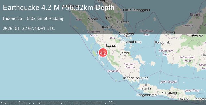
A 4.2 magnitude earthquake struck on Southern Sumatra, Indonesia, at Thu, 22 Jan 2026 02:40:04 GMT. Depth: 56.323059km. Reviewed by BMKG seismologists, this light quake occurred at a magnitude type of M.
Magnitude
4.2
M
Source
BMKG
Intensity
-
Agency Reports
1 Sources| Source | Magnitude | Depth | Time |
|---|---|---|---|
| BMKGPrimary | 4.2 | 56 km | 5 days ago |
Earthquake Details
AutomaticEvent IDbmg2026bmov
Tsunami PotentialNo
Magnitude TypeM
Nearest Places
- Pulau Merak6.0 km
- Pulau Bintanggor6.9 km
- Pulau Sibuntar7.2 km
- Pulau Karanganggo7.2 km
- Ujung Kayumanang7.8 km
Comments
Join the discussion about this event.
Latest Earthquakes
3.1Mag
South of Java, Indonesia
Time3 minutes ago
Depth5.01 km
SourceBMKG (Automatic)
2.2Mag
Near North Coast of West Papua
Time6 minutes ago
Depth10.00 km
SourceBMKG (Automatic)
1.6Mag
4 km SE of Julian, CA
Time22 minutes ago
Depth10.57 km
SourceUSGS (Automatic)
3.4Mag
BIO-BIO, CHILE
Time24 minutes ago
Depth17.50 km
SourceCSN (Automatic)
2.7Mag
FRANCE
Time30 minutes ago
Depth5.00 km
SourceReNaSS (Automatic)
Nearby Earthquakes
4.1Mag
KEP. MENTAWAI REGION, INDONESIA
Time6 days ago
Depth48.00 km
SourceBMKG (Automatic)
2.6Mag
Southern Sumatra, Indonesia
Time6 days ago
Depth10.00 km
SourceBMKG (Automatic)
3.8Mag
Southern Sumatra, Indonesia
Time5 days ago
Depth3.60 km
SourceBMKG (Automatic)
3.5Mag
Southern Sumatra, Indonesia
Time22 hours ago
Depth46.40 km
SourceBMKG (Automatic)
2.5Mag
NORTHERN SUMATRA, INDONESIA
Time3 days ago
Depth8.00 km
SourceBMKG (Automatic)