Earthquake West Papua Region, Indonesia
Thu, 22 Jan 2026 22:14:33 GMT
Time4 days ago
Location
-0.7163, 131.4896
Depth
10.0 KM
Event Summary
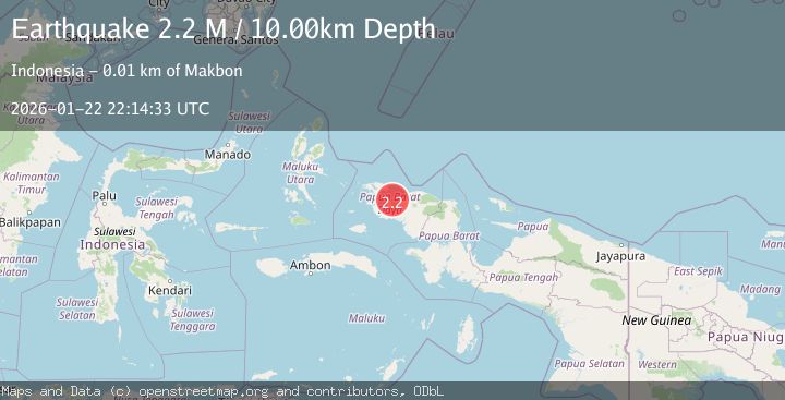
A 2.2 magnitude earthquake struck on West Papua Region, Indonesia, at Thu, 22 Jan 2026 22:14:33 GMT. Depth: 10km. Reviewed by BMKG seismologists, this minor quake occurred at a magnitude type of M.
Magnitude
2.2
M
Source
BMKG
Intensity
-
Agency Reports
1 Sources| Source | Magnitude | Depth | Time |
|---|---|---|---|
| BMKGPrimary | 2.2 | 10 km | 4 days ago |
Earthquake Details
AutomaticEvent IDbmg2026bobp
Tsunami PotentialNo
Magnitude TypeM
Nearest Places
- Tanjung Elpapa2.0 km
- Kampung Teluk Dore4.4 km
- Kelurahan Makbon5.3 km
- Tanjung Dore5.7 km
- Seleber6.2 km
Comments
Join the discussion about this event.
Latest Earthquakes
1.5Mag
16 km WSW of Johannesburg, CA
Time9 minutes ago
Depth8.58 km
SourceUSGS (Automatic)
1.9Mag
20 km SE of Naalehu, Hawaii
Time18 minutes ago
Depth34.08 km
SourceUSGS (Automatic)
1.6Mag
CENTRAL TURKEY
Time20 minutes ago
Depth7.00 km
SourceAFAD (Automatic)
3.4Mag
Banda Sea
Time24 minutes ago
Depth159.46 km
SourceBMKG (Automatic)
2.3Mag
SICILY, ITALY
Time28 minutes ago
Depth7.70 km
SourceINGV (Automatic)
Nearby Earthquakes
2.3Mag
West Papua Region, Indonesia
Time4 days ago
Depth10.00 km
SourceBMKG (Automatic)
2.2Mag
West Papua Region, Indonesia
Time3 days ago
Depth10.00 km
SourceBMKG (Automatic)
2.6Mag
West Papua Region, Indonesia
Time6 days ago
Depth10.00 km
SourceBMKG (Automatic)
2.3Mag
West Papua Region, Indonesia
Time18 hours ago
Depth10.00 km
SourceBMKG (Automatic)
2.5Mag
West Papua Region, Indonesia
Time4 days ago
Depth10.00 km
SourceBMKG (Automatic)