Earthquake West Papua Region, Indonesia
Mon, 26 Jan 2026 23:08:20 GMT
Time16 hours ago
Location
-0.6659, 131.8303
Depth
10.0 KM
Event Summary
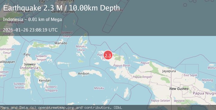
A 2.2 magnitude earthquake struck on West Papua Region, Indonesia, at Mon, 26 Jan 2026 23:08:20 GMT. Depth: 10km. Reviewed by BMKG seismologists, this minor quake occurred at a magnitude type of M.
Magnitude
2.2
M
Source
BMKG
Intensity
-
Agency Reports
1 Sources| Source | Magnitude | Depth | Time |
|---|---|---|---|
| BMKGPrimary | 2.2 | 10 km | 16 hours ago |
Earthquake Details
AutomaticEvent IDbmg2026bvlj
Tsunami PotentialNo
Magnitude TypeM
Nearest Places
- Olifantberg6.9 km
- Kampung Klasbon7.0 km
- Sungai Kelabesi8.0 km
- Sungai Mega8.2 km
- Mega8.3 km
Comments
Join the discussion about this event.
Latest Earthquakes
2.3Mag
18 km SSE of Pope-Vannoy Landing, Alaska
Time16 hours ago
Depth5.50 km
SourceUSGS (Automatic)
3.1Mag
SOUTH ISLAND OF NEW ZEALAND
Time16 hours ago
Depth55.40 km
SourceGNS (Automatic)
2.9Mag
Java, Indonesia
Time16 hours ago
Depth28.53 km
SourceBMKG (Automatic)
2.5Mag
64 km ESE of Adak, Alaska
Time16 hours ago
Depth41.90 km
SourceUSGS
2.0Mag
128 km E of McCarthy, Alaska
Time16 hours ago
Depth0.40 km
SourceUSGS
Nearby Earthquakes
2.2Mag
West Papua Region, Indonesia
Time3 days ago
Depth10.00 km
SourceBMKG (Automatic)
2.5Mag
West Papua Region, Indonesia
Time4 days ago
Depth10.00 km
SourceBMKG (Automatic)
2.6Mag
West Papua Region, Indonesia
Time6 days ago
Depth10.00 km
SourceBMKG (Automatic)
2.3Mag
West Papua Region, Indonesia
Time4 days ago
Depth10.00 km
SourceBMKG (Automatic)
2.2Mag
West Papua Region, Indonesia
Time4 days ago
Depth10.00 km
SourceBMKG (Automatic)