Earthquake South of Bali, Indonesia
Sat, 24 Jan 2026 08:26:30 GMT
Time3 days ago
Location
-9.4020, 115.8841
Depth
27.2 KM
Event Summary
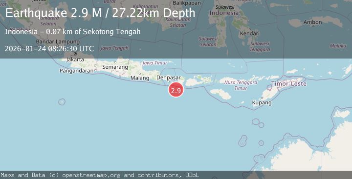
A 2.9 magnitude earthquake struck on South of Bali, Indonesia, at Sat, 24 Jan 2026 08:26:30 GMT. Depth: 27.222013km. Reviewed by BMKG seismologists, this minor quake occurred at a magnitude type of M.
Magnitude
2.9
M
Source
BMKG
Intensity
-
Agency Reports
1 Sources| Source | Magnitude | Depth | Time |
|---|---|---|---|
| BMKGPrimary | 2.9 | 27 km | 3 days ago |
Earthquake Details
AutomaticEvent IDbmg2026bqrh
Tsunami PotentialNo
Magnitude TypeM
Nearest Places
- Lombok Basin49.6 km
- Pulau Sophialouisa54.6 km
- Gili Sarangburung57.3 km
- Tanjung Panggang57.6 km
- Gili Luah58.0 km
Comments
Join the discussion about this event.
Latest Earthquakes
2.6Mag
Northern Sumatra, Indonesia
Time7 minutes ago
Depth0.60 km
SourceBMKG (Automatic)
2.1Mag
SOUTHERN TEXAS
Time7 minutes ago
Depth0.00 km
SourceTX (Automatic)
3.8Mag
ATACAMA, CHILE
Time14 minutes ago
Depth98.00 km
SourceCSN (Automatic)
0.9Mag
EASTERN TURKEY
Time14 minutes ago
Depth6.80 km
SourceAFAD (Automatic)
2.4Mag
EASTERN TURKEY
Time17 minutes ago
Depth4.30 km
SourceKOERI (Automatic)
Nearby Earthquakes
2.6Mag
South of Bali, Indonesia
Time17 hours ago
Depth158.81 km
SourceBMKG (Automatic)
2.7Mag
Sumbawa Region, Indonesia
Time5 days ago
Depth29.18 km
SourceBMKG (Automatic)
3.0Mag
Sumbawa Region, Indonesia
Time2 days ago
Depth10.00 km
SourceBMKG (Automatic)
2.7Mag
LOMBOK REGION, INDONESIA
Time3 days ago
Depth10.00 km
SourceBMKG (Automatic)
2.6Mag
South of Bali, Indonesia
Time1 day ago
Depth19.30 km
SourceBMKG (Automatic)