Earthquake Bali Region, Indonesia
Sat, 24 Jan 2026 10:30:10 GMT
Time3 days ago
Location
-8.7358, 114.0348
Depth
92.1 KM
Event Summary
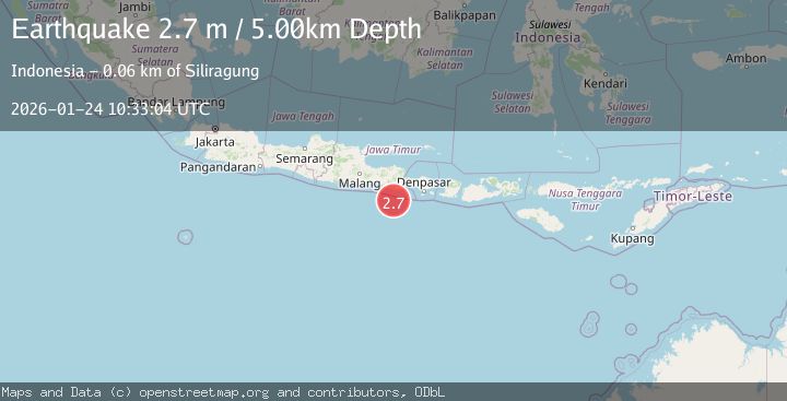
A 2.7 magnitude earthquake struck on Bali Region, Indonesia, at Sat, 24 Jan 2026 10:30:10 GMT. Depth: 92.14km. Reviewed by BMKG seismologists, this minor quake occurred at a magnitude type of M.
Magnitude
2.7
M
Source
BMKG
Intensity
-
Agency Reports
1 Sources| Source | Magnitude | Depth | Time |
|---|---|---|---|
| BMKGPrimary | 2.7 | 5 km | 3 days ago |
Earthquake Details
AutomaticEvent IDbmg2026bqvj
Tsunami PotentialNo
Magnitude TypeM
Nearest Places
- Shangri-La Hotel Futian2.1 km
- Holiday Inn Express Luohu7.9 km
- Best Western Shenzhen Felicity8.4 km
- Gs International Hotel9.0 km
- Pulau Mustaka9.9 km
Comments
Join the discussion about this event.
Latest Earthquakes
3.7Mag
VALPARAISO, CHILE
Time4 minutes ago
Depth27.60 km
SourceCSN (Automatic)
2.0Mag
CENTRAL TURKEY
Time7 minutes ago
Depth23.50 km
SourceKOERI (Automatic)
3.2Mag
OFFSHORE EL SALVADOR
Time8 minutes ago
Depth28.00 km
SourceINET (Automatic)
3.1Mag
South of Java, Indonesia
Time8 minutes ago
Depth5.01 km
SourceBMKG (Automatic)
2.2Mag
Near North Coast of West Papua
Time11 minutes ago
Depth10.00 km
SourceBMKG (Automatic)
Nearby Earthquakes
2.7Mag
South of Java, Indonesia
Time4 days ago
Depth30.00 km
SourceBMKG (Automatic)
2.5Mag
Bali Region, Indonesia
Time5 days ago
Depth105.42 km
SourceBMKG (Automatic)
3.0Mag
South of Bali, Indonesia
Time36 minutes ago
Depth21.74 km
SourceBMKG (Automatic)
2.7Mag
South of Bali, Indonesia
Time5 days ago
Depth21.49 km
SourceBMKG (Automatic)
3.6Mag
South of Java, Indonesia
Time23 hours ago
Depth27.60 km
SourceBMKG (Automatic)