Earthquake Flores Sea
Mon, 26 Jan 2026 03:26:15 GMT
Time1 day ago
Location
-7.4896, 120.0609
Depth
403.6 KM
Event Summary
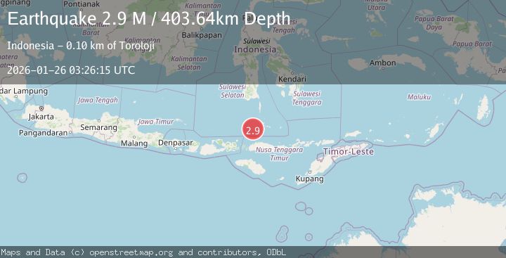
A 2.9 magnitude earthquake struck on Flores Sea, at Mon, 26 Jan 2026 03:26:15 GMT. Depth: 403.641144km. Reviewed by BMKG seismologists, this minor quake occurred at a magnitude type of M.
Magnitude
2.9
M
Source
BMKG
Intensity
-
Agency Reports
1 Sources| Source | Magnitude | Depth | Time |
|---|---|---|---|
| BMKGPrimary | 2.9 | 404 km | 1 day ago |
Earthquake Details
AutomaticEvent IDbmg2026btyj
Tsunami PotentialNo
Magnitude TypeM
Nearest Places
- Flores Basin29.7 km
- Karang Taka Kapalle57.1 km
- Pulau Bembe71.3 km
- Pulau Pangendangan71.4 km
- Kampungbembe71.7 km
Comments
Join the discussion about this event.
Latest Earthquakes
1.5Mag
16 km WSW of Johannesburg, CA
Time9 minutes ago
Depth8.58 km
SourceUSGS (Automatic)
1.9Mag
20 km SE of Naalehu, Hawaii
Time18 minutes ago
Depth34.08 km
SourceUSGS (Automatic)
1.6Mag
CENTRAL TURKEY
Time20 minutes ago
Depth7.00 km
SourceAFAD (Automatic)
3.4Mag
Banda Sea
Time24 minutes ago
Depth159.46 km
SourceBMKG (Automatic)
2.3Mag
SICILY, ITALY
Time28 minutes ago
Depth7.70 km
SourceINGV (Automatic)
Nearby Earthquakes
4.2Mag
Flores Sea
Time1 day ago
Depth387.35 km
SourceBMKG (Automatic)
2.6Mag
Flores Sea
Time2 days ago
Depth132.04 km
SourceBMKG (Automatic)
2.7Mag
Flores Sea
Time6 days ago
Depth3.32 km
SourceBMKG (Automatic)
2.8Mag
Flores Region, Indonesia
Time4 days ago
Depth174.48 km
SourceBMKG (Automatic)
2.5Mag
Flores Region, Indonesia
Time1 day ago
Depth179.70 km
SourceBMKG (Automatic)