Earthquake Flores Sea
Mon, 26 Jan 2026 01:56:27 GMT
Time1 day ago
Location
-7.4803, 119.9560
Depth
387.4 KM
Event Summary
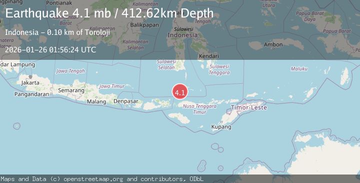
A 4.2 magnitude earthquake struck on Flores Sea, at Mon, 26 Jan 2026 01:56:27 GMT. Depth: 387.354523km. Reviewed by BMKG seismologists, this light quake occurred at a magnitude type of M.
Magnitude
4.2
M
Source
BMKG
Intensity
-
Agency Reports
2 Sources| Source | Magnitude | Depth | Time |
|---|---|---|---|
| BMKGPrimary | 4.2 | 387 km | 1 day ago |
| USGS | 4.1 | 413 km | 1 day ago |
Earthquake Details
AutomaticEvent IDbmg2026btvk
Tsunami PotentialNo
Magnitude TypeM
Nearest Places
- Flores Basin30.4 km
- Karang Taka Kapalle64.9 km
- Karang Sanesane78.9 km
- Pulau Pangendangan79.7 km
- Pulau Bembe79.8 km
Comments
Join the discussion about this event.
Latest Earthquakes
3.8Mag
EASTERN TURKEY
Time7 minutes ago
Depth0.00 km
SourceKOERI (Automatic)
2.7Mag
West Papua Region, Indonesia
Time10 minutes ago
Depth14.59 km
SourceBMKG (Automatic)
2.1Mag
Flores Region, Indonesia
Time12 minutes ago
Depth10.00 km
SourceBMKG (Automatic)
3.7Mag
LA RIOJA, ARGENTINA
Time20 minutes ago
Depth119.00 km
SourceNSNA (Automatic)
2.2Mag
Savu Sea
Time21 minutes ago
Depth56.18 km
SourceBMKG (Automatic)
Nearby Earthquakes
2.9Mag
Flores Sea
Time1 day ago
Depth403.64 km
SourceBMKG (Automatic)
2.6Mag
Flores Sea
Time2 days ago
Depth132.04 km
SourceBMKG (Automatic)
2.8Mag
Flores Region, Indonesia
Time4 days ago
Depth174.48 km
SourceBMKG (Automatic)
2.7Mag
Flores Sea
Time6 days ago
Depth3.32 km
SourceBMKG (Automatic)
2.5Mag
Flores Region, Indonesia
Time1 day ago
Depth179.70 km
SourceBMKG (Automatic)