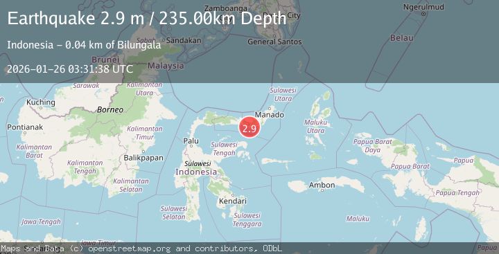
Earthquake Minahassa Peninsula, Sulawesi
Mon, 26 Jan 2026 03:31:38 GMT
Time1 day ago
Location
0.3397, 123.5939
Depth
235.3 KM
Event Summary
A 2.9 magnitude earthquake struck on Minahassa Peninsula, Sulawesi, at Mon, 26 Jan 2026 03:31:38 GMT. Depth: 235.33075km. Reviewed by BMKG seismologists, this minor quake occurred at a magnitude type of M.
Magnitude
2.9
M
Source
BMKG
Intensity
-
Agency Reports
1 Sources| Source | Magnitude | Depth | Time |
|---|---|---|---|
| BMKGPrimary | 2.9 | 235 km | 1 day ago |
Earthquake Details
AutomaticEvent IDbmg2026btyo
Tsunami PotentialNo
Magnitude TypeM
Nearest Places
- Dutula Omuto2.4 km
- Huidu Momalia2.4 km
- Desa Momalia Tiga2.5 km
- Desa Momalia II2.6 km
- Longo2.8 km
Comments
Join the discussion about this event.
Latest Earthquakes
1.3Mag
24 km NNW of Westbrook, Texas
Time2 hours ago
Depth3.71 km
SourceUSGS (Automatic)
2.2Mag
BAJA CALIFORNIA, MEXICO
Time2 hours ago
Depth1.20 km
SourceSCSN (Automatic)
3.4Mag
ATACAMA, CHILE
Time2 hours ago
Depth24.80 km
SourceCSN (Automatic)
1.7Mag
3 km NE of Oakland, CA
Time2 hours ago
Depth8.73 km
SourceUSGS (Automatic)
2.0Mag
35 km SSE of Denali National Park, Alaska
Time2 hours ago
Depth0.10 km
SourceUSGS (Automatic)
Nearby Earthquakes
2.9Mag
Minahassa Peninsula, Sulawesi
Time2 days ago
Depth95.96 km
SourceBMKG (Automatic)
2.4Mag
Minahassa Peninsula, Sulawesi
Time2 days ago
Depth131.42 km
SourceBMKG (Automatic)
2.6Mag
Minahassa Peninsula, Sulawesi
Time8 hours ago
Depth118.00 km
SourceBMKG (Automatic)
2.8Mag
Minahassa Peninsula, Sulawesi
Time4 days ago
Depth18.33 km
SourceBMKG (Automatic)
3.0Mag
Minahassa Peninsula, Sulawesi
Time2 days ago
Depth55.68 km
SourceBMKG (Automatic)