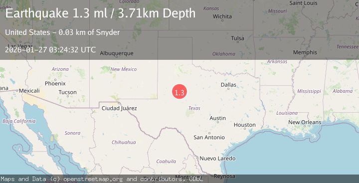
Earthquake 24 km NNW of Westbrook, Texas
Tue, 27 Jan 2026 03:24:32 GMT
Time3 hours ago
Location
32.5600, -101.1150
Depth
3.7 KM
Event Summary
A 1.3 magnitude earthquake struck on 24 km NNW of Westbrook, Texas, at Tue, 27 Jan 2026 03:24:32 GMT. Depth: 3.7143km. Reviewed by USGS seismologists, this minor quake occurred at a magnitude type of ml.
Magnitude
1.3
ml
Source
USGS
Intensity
-
Agency Reports
1 Sources| Source | Magnitude | Depth | Time |
|---|---|---|---|
| USGSPrimary | 1.3 | 4 km | 3 hours ago |
Earthquake Details
AutomaticEvent IDusgs_tx2026bvzrdw
Tsunami PotentialNo
Magnitude Typeml
Nearest Places
- Bull Creek3.1 km
- Lake J B Thomas Dam3.2 km
- Dunn Lake4.1 km
- Dunn Lake Dam4.2 km
- Bluff Creek5.7 km
Comments
Join the discussion about this event.
Latest Earthquakes
1.9Mag
5 km ESE of Pearsall, Texas
Time8 minutes ago
Depth8.84 km
SourceUSGS (Automatic)
3.9Mag
Minahassa Peninsula, Sulawesi
Time13 minutes ago
Depth203.73 km
SourceBMKG (Automatic)
2.6Mag
SUMBAWA REGION, INDONESIA
Time14 minutes ago
Depth184.00 km
SourceBMKG (Automatic)
1.5Mag
6 km SW of Gilroy, CA
Time16 minutes ago
Depth2.74 km
SourceUSGS (Automatic)
4.1Mag
OFFSHORE GUATEMALA
Time19 minutes ago
Depth10.00 km
SourceINET (Automatic)
Nearby Earthquakes
1.6Mag
25 km SW of Snyder, Texas
Time5 hours ago
Depth0.55 km
SourceUSGS (Automatic)
1.2Mag
24 km SW of Snyder, Texas
Time15 hours ago
Depth3.17 km
SourceUSGS (Automatic)
4.3Mag
WESTERN TEXAS
Time20 hours ago
Depth6.50 km
SourceTX (Automatic)
1.7Mag
23 km SW of Snyder, Texas
Time19 hours ago
Depth2.60 km
SourceUSGS (Automatic)
0.9Mag
23 km SW of Snyder, Texas
Time13 hours ago
Depth3.41 km
SourceUSGS (Automatic)