Earthquake Sumba Region, Indonesia
Mon, 26 Jan 2026 04:41:24 GMT
Time1 day ago
Location
-9.0674, 119.2109
Depth
81.7 KM
Event Summary
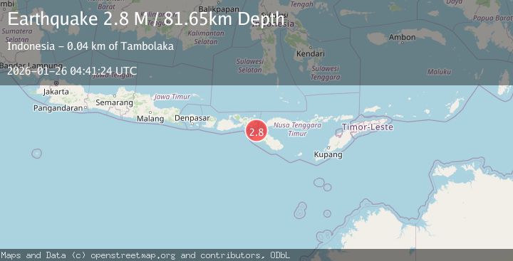
A 2.8 magnitude earthquake struck on Sumba Region, Indonesia, at Mon, 26 Jan 2026 04:41:24 GMT. Depth: 81.65332km. Reviewed by BMKG seismologists, this minor quake occurred at a magnitude type of M.
Magnitude
2.8
M
Source
BMKG
Intensity
-
Agency Reports
1 Sources| Source | Magnitude | Depth | Time |
|---|---|---|---|
| BMKGPrimary | 2.8 | 82 km | 1 day ago |
Earthquake Details
AutomaticEvent IDbmg2026buaw
Tsunami PotentialNo
Magnitude TypeM
Nearest Places
- Selat Sumba8.6 km
- Tanjung Oro31.7 km
- Luku Oro32.0 km
- Tanjung Nangaamba32.9 km
- Sungai Newa33.3 km
Comments
Join the discussion about this event.
Latest Earthquakes
2.6Mag
West Papua Region, Indonesia
Time9 hours ago
Depth10.93 km
SourceBMKG (Automatic)
2.5Mag
BAJA CALIFORNIA, MEXICO
Time9 hours ago
Depth20.50 km
SourceSCSN (Automatic)
2.9Mag
Sumba Region, Indonesia
Time9 hours ago
Depth4.58 km
SourceBMKG (Automatic)
1.6Mag
21 km WNW of Stanton, Texas
Time9 hours ago
Depth3.55 km
SourceUSGS (Automatic)
5.2Mag
EAST OF KURIL ISLANDS
Time9 hours ago
Depth13.00 km
SourceEMSC (Automatic)
Nearby Earthquakes
2.6Mag
Sumba Region, Indonesia
Time1 day ago
Depth51.36 km
SourceBMKG (Automatic)
2.4Mag
Flores Region, Indonesia
Time5 days ago
Depth10.00 km
SourceBMKG (Automatic)
2.3Mag
Sumba Region, Indonesia
Time19 hours ago
Depth63.48 km
SourceBMKG (Automatic)
2.2Mag
Sumbawa Region, Indonesia
Time4 days ago
Depth10.00 km
SourceBMKG (Automatic)
2.1Mag
Flores Region, Indonesia
Time2 days ago
Depth114.68 km
SourceBMKG (Automatic)