Earthquake West Papua Region, Indonesia
Mon, 26 Jan 2026 06:10:52 GMT
Time3 days ago
Location
-1.4506, 135.9757
Depth
33.2 KM
Event Summary
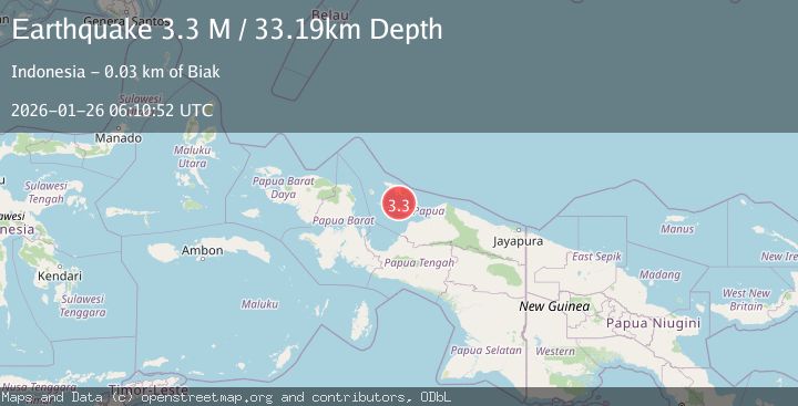
A 3.3 magnitude earthquake struck on West Papua Region, Indonesia, at Mon, 26 Jan 2026 06:10:52 GMT. Depth: 33.189075km. Reviewed by BMKG seismologists, this minor quake occurred at a magnitude type of M.
Magnitude
3.3
M
Source
BMKG
Intensity
-
Agency Reports
1 Sources| Source | Magnitude | Depth | Time |
|---|---|---|---|
| BMKGPrimary | 3.3 | 33 km | 3 days ago |
Earthquake Details
AutomaticEvent IDbmg2026budv
Tsunami PotentialNo
Magnitude TypeM
Nearest Places
- Pulau Miosindi18.1 km
- Samberi18.4 km
- Tanjung Murui21.4 km
- Selat Sorenarwa21.9 km
- Tanjung Soressi22.2 km
Comments
Join the discussion about this event.
Latest Earthquakes
2.6Mag
ANTOFAGASTA, CHILE
Time5 minutes ago
Depth66.10 km
SourceCSN (Automatic)
3.0Mag
NORTH ISLAND OF NEW ZEALAND
Time10 minutes ago
Depth16.90 km
SourceGNS (Automatic)
2.8Mag
SAN JUAN, ARGENTINA
Time12 minutes ago
Depth88.00 km
SourceNSNA (Automatic)
4.1Mag
SOUTHERN YUKON TERRITORY, CANADA
Time19 minutes ago
Depth0.50 km
SourceAK (Automatic)
3.1Mag
ISLAND OF HAWAII, HAWAII
Time19 minutes ago
Depth6.90 km
SourceHV (Automatic)
Nearby Earthquakes
2.5Mag
West Papua Region, Indonesia
Time1 week ago
Depth10.00 km
SourceBMKG (Automatic)
3.0Mag
West Papua Region, Indonesia
Time1 week ago
Depth10.00 km
SourceBMKG (Automatic)
2.4Mag
West Papua Region, Indonesia
Time5 days ago
Depth10.00 km
SourceBMKG (Automatic)
2.8Mag
West Papua Region, Indonesia
Time5 hours ago
Depth19.31 km
SourceBMKG (Automatic)
2.8Mag
West Papua Region, Indonesia
Time5 days ago
Depth10.00 km
SourceBMKG (Automatic)