Earthquake West Papua Region, Indonesia
Thu, 29 Jan 2026 18:14:55 GMT
Time1 hour ago
Location
-2.6040, 136.9057
Depth
19.3 KM
Event Summary
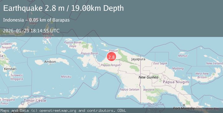
A 2.8 magnitude earthquake struck on West Papua Region, Indonesia, at Thu, 29 Jan 2026 18:14:55 GMT. Depth: 19.31114km. Reviewed by BMKG seismologists, this minor quake occurred at a magnitude type of M.
Magnitude
2.8
M
Source
BMKG
Intensity
-
Agency Reports
1 Sources| Source | Magnitude | Depth | Time |
|---|---|---|---|
| BMKGPrimary | 2.8 | 19 km | 1 hour ago |
Earthquake Details
AutomaticEvent IDbmg2026caof
Tsunami PotentialNo
Magnitude TypeM
Nearest Places
- Kampung Biati2.5 km
- Gunung Dom7.4 km
- Distrik Demba7.9 km
- Kampung Sirami8.0 km
- Pegunungan Sudirman9.6 km
Comments
Join the discussion about this event.
Latest Earthquakes
1.8Mag
9 km NW of The Geysers, CA
Time1 hour ago
Depth1.95 km
SourceUSGS (Automatic)
1.9Mag
32 km ENE of Boulder City, Nevada
Time1 hour ago
Depth5.75 km
SourceUSGS (Automatic)
3.1Mag
SAN JUAN, ARGENTINA
Time2 hours ago
Depth10.00 km
SourceNSNA (Automatic)
2.4Mag
Minahassa Peninsula, Sulawesi
Time2 hours ago
Depth65.05 km
SourceBMKG (Automatic)
1.5Mag
WESTERN TURKEY
Time2 hours ago
Depth7.00 km
SourceAFAD (Automatic)
Nearby Earthquakes
2.5Mag
PAPUA, INDONESIA
Time4 hours ago
Depth10.00 km
SourceBMKG (Automatic)
4.3Mag
West Papua, Indonesia
Time1 week ago
Depth79.49 km
SourceBMKG (Automatic)
2.5Mag
West Papua Region, Indonesia
Time1 week ago
Depth10.00 km
SourceBMKG (Automatic)
3.6Mag
West Papua Region, Indonesia
Time1 week ago
Depth10.00 km
SourceBMKG (Automatic)
2.6Mag
West Papua Region, Indonesia
Time3 days ago
Depth10.00 km
SourceBMKG (Automatic)