Earthquake Near North Coast of West Papua
Mon, 26 Jan 2026 07:03:29 GMT
Time1 day ago
Location
-2.9512, 139.6983
Depth
9.7 KM
Event Summary
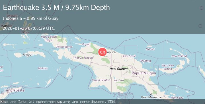
A 3.5 magnitude earthquake struck on Near North Coast of West Papua, at Mon, 26 Jan 2026 07:03:29 GMT. Depth: 9.747958km. Reviewed by BMKG seismologists, this minor quake occurred at a magnitude type of M.
Magnitude
3.5
M
Source
BMKG
Intensity
-
Agency Reports
1 Sources| Source | Magnitude | Depth | Time |
|---|---|---|---|
| BMKGPrimary | 3.5 | 10 km | 1 day ago |
Earthquake Details
AutomaticEvent IDbmg2026bufo
Tsunami PotentialNo
Magnitude TypeM
Nearest Places
- Barito1.1 km
- Desa Kobi15.2 km
- Dore17.6 km
- Kampung Tetom19.0 km
- Kampung Umbron19.4 km
Comments
Join the discussion about this event.
Latest Earthquakes
1.5Mag
6 km SW of Gilroy, CA
Time8 hours ago
Depth2.74 km
SourceUSGS (Automatic)
1.6Mag
WESTERN TURKEY
Time8 hours ago
Depth10.10 km
SourceEMSC (Automatic)
2.8Mag
SAN JUAN, ARGENTINA
Time8 hours ago
Depth108.00 km
SourceNSNA (Automatic)
1.6Mag
WESTERN TURKEY
Time8 hours ago
Depth13.90 km
SourceEMSC (Automatic)
2.4Mag
PUERTO RICO REGION
Time9 hours ago
Depth12.10 km
SourcePR (Automatic)
Nearby Earthquakes
3.5Mag
Near North Coast of West Papua
Time1 day ago
Depth67.58 km
SourceBMKG (Automatic)
2.4Mag
Near North Coast of West Papua
Time2 days ago
Depth10.00 km
SourceBMKG (Automatic)
2.6Mag
West Papua, Indonesia
Time2 days ago
Depth22.39 km
SourceBMKG (Automatic)
2.5Mag
West Papua, Indonesia
Time4 days ago
Depth10.00 km
SourceBMKG (Automatic)
2.4Mag
Near North Coast of West Papua
Time5 days ago
Depth18.12 km
SourceBMKG (Automatic)