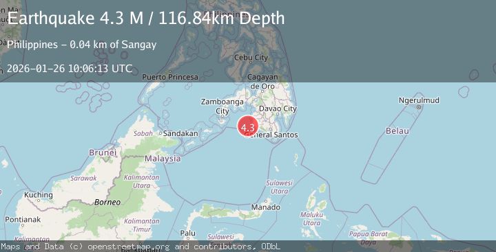
Earthquake Mindanao, Philippines
Mon, 26 Jan 2026 10:06:13 GMT
Time1 day ago
Location
6.2990, 123.7349
Depth
116.8 KM
Event Summary
A 4.3 magnitude earthquake struck on Mindanao, Philippines, at Mon, 26 Jan 2026 10:06:13 GMT. Depth: 116.841293km. Reviewed by BMKG seismologists, this light quake occurred at a magnitude type of M.
Magnitude
4.3
M
Source
BMKG
Intensity
-
Agency Reports
1 Sources| Source | Magnitude | Depth | Time |
|---|---|---|---|
| BMKGPrimary | 4.3 | 117 km | 1 day ago |
Earthquake Details
AutomaticEvent IDbmg2026bulp
Tsunami PotentialNo
Magnitude TypeM
Nearest Places
- Sangay Point36.1 km
- Donauang Island36.5 km
- Kiponget36.6 km
- Tuna Point36.6 km
- Heart Break Beach36.7 km
Comments
Join the discussion about this event.
Latest Earthquakes
2.4Mag
NEVADA
Time6 minutes ago
Depth16.00 km
SourceNN (Automatic)
3.1Mag
Northern Molucca Sea
Time8 minutes ago
Depth31.63 km
SourceBMKG (Automatic)
2.1Mag
SOUTHERN ITALY
Time12 minutes ago
Depth10.00 km
SourceINGV (Automatic)
2.6Mag
Northern Sumatra, Indonesia
Time13 minutes ago
Depth0.60 km
SourceBMKG (Automatic)
2.1Mag
SOUTHERN TEXAS
Time13 minutes ago
Depth0.00 km
SourceTX (Automatic)
Nearby Earthquakes
3.0Mag
MORO GULF, MINDANAO, PHILIPPINES
Time5 days ago
Depth24.00 km
SourcePIVS (Automatic)
3.1Mag
MORO GULF, MINDANAO, PHILIPPINES
Time3 days ago
Depth20.00 km
SourcePIVS (Automatic)
5.4Mag
32 km WSW of Sangay, Philippines
Time6 days ago
Depth8.76 km
SourceUSGS
3.4Mag
MORO GULF, MINDANAO, PHILIPPINES
Time5 days ago
Depth23.00 km
SourcePIVS (Automatic)
3.2Mag
MORO GULF, MINDANAO, PHILIPPINES
Time5 days ago
Depth1.00 km
SourcePIVS (Automatic)