Earthquake Northern Molucca Sea
Tue, 27 Jan 2026 10:38:35 GMT
Time1 hour ago
Location
1.2692, 126.4543
Depth
31.6 KM
Event Summary
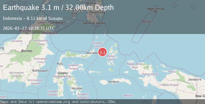
A 3.1 magnitude earthquake struck on Northern Molucca Sea, at Tue, 27 Jan 2026 10:38:35 GMT. Depth: 31.632689km. Reviewed by BMKG seismologists, this minor quake occurred at a magnitude type of M.
Magnitude
3.1
M
Source
BMKG
Intensity
-
Agency Reports
1 Sources| Source | Magnitude | Depth | Time |
|---|---|---|---|
| BMKGPrimary | 3.1 | 32 km | 1 hour ago |
Earthquake Details
AutomaticEvent IDbmg2026bwid
Tsunami PotentialNo
Magnitude TypeM
Nearest Places
- Tanjung Geranomaderi7.9 km
- Kelurahan Bido8.9 km
- Kelurahan Lelewi9.1 km
- Kecamatan Pulau Batang Dua9.7 km
- Pulau Mayu9.8 km
Comments
Join the discussion about this event.
Latest Earthquakes
2.4Mag
NEVADA
Time1 hour ago
Depth16.00 km
SourceNN (Automatic)
2.6Mag
Northern Sumatra, Indonesia
Time1 hour ago
Depth0.60 km
SourceBMKG (Automatic)
2.1Mag
SOUTHERN TEXAS
Time1 hour ago
Depth0.00 km
SourceTX (Automatic)
3.8Mag
ATACAMA, CHILE
Time1 hour ago
Depth98.00 km
SourceCSN (Automatic)
0.9Mag
EASTERN TURKEY
Time1 hour ago
Depth6.80 km
SourceAFAD (Automatic)
Nearby Earthquakes
4.7Mag
Northern Molucca Sea
Time5 days ago
Depth23.34 km
SourceBMKG (Automatic)
3.0Mag
Northern Molucca Sea
Time1 day ago
Depth25.04 km
SourceBMKG (Automatic)
3.1Mag
Northern Molucca Sea
Time2 days ago
Depth27.94 km
SourceBMKG (Automatic)
2.6Mag
Northern Molucca Sea
Time2 days ago
Depth61.16 km
SourceBMKG (Automatic)
3.8Mag
Northern Molucca Sea
Time3 hours ago
Depth106.66 km
SourceBMKG (Automatic)