Earthquake Minahassa Peninsula, Sulawesi
Mon, 26 Jan 2026 10:57:32 GMT
Time21 hours ago
Location
0.4073, 122.3724
Depth
63.6 KM
Event Summary
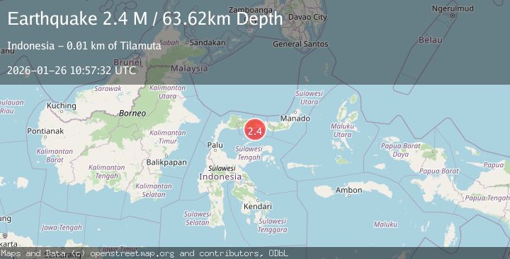
A 2.4 magnitude earthquake struck on Minahassa Peninsula, Sulawesi, at Mon, 26 Jan 2026 10:57:32 GMT. Depth: 63.621071km. Reviewed by BMKG seismologists, this minor quake occurred at a magnitude type of M.
Magnitude
2.4
M
Source
BMKG
Intensity
-
Agency Reports
1 Sources| Source | Magnitude | Depth | Time |
|---|---|---|---|
| BMKGPrimary | 2.4 | 64 km | 21 hours ago |
Earthquake Details
AutomaticEvent IDbmg2026bunh
Tsunami PotentialNo
Magnitude TypeM
Nearest Places
- Lito Mohupombo Kiki7.0 km
- Lito Molopinggulo7.1 km
- Lito Mohupombo Daa7.2 km
- Lito Podo8.3 km
- Lito Asiangi8.8 km
Comments
Join the discussion about this event.
Latest Earthquakes
2.1Mag
Near North Coast of West Papua
Time21 hours ago
Depth10.00 km
SourceBMKG (Automatic)
4.4Mag
SOUTHERN ALASKA
Time21 hours ago
Depth20.00 km
SourceAK (Automatic)
1.3Mag
11 km N of Piru, CA
Time22 hours ago
Depth6.34 km
SourceUSGS (Automatic)
4.4Mag
SOUTHWESTERN RYUKYU ISL., JAPAN
Time22 hours ago
Depth50.00 km
SourceJMA (Automatic)
2.6Mag
OFFSHORE COQUIMBO, CHILE
Time22 hours ago
Depth15.10 km
SourceCSN (Automatic)
Nearby Earthquakes
2.4Mag
Minahassa Peninsula, Sulawesi
Time4 days ago
Depth149.71 km
SourceBMKG (Automatic)
2.0Mag
Minahassa Peninsula, Sulawesi
Time6 days ago
Depth2.50 km
SourceBMKG (Automatic)
2.3Mag
Minahassa Peninsula, Sulawesi
Time5 days ago
Depth154.22 km
SourceBMKG (Automatic)
2.3Mag
Minahassa Peninsula, Sulawesi
Time4 days ago
Depth68.84 km
SourceBMKG (Automatic)
2.4Mag
Minahassa Peninsula, Sulawesi
Time5 days ago
Depth60.37 km
SourceBMKG (Automatic)