Earthquake Sumbawa Region, Indonesia
Tue, 27 Jan 2026 10:13:34 GMT
Time2 hours ago
Location
-9.1492, 118.8325
Depth
82.7 KM
Event Summary
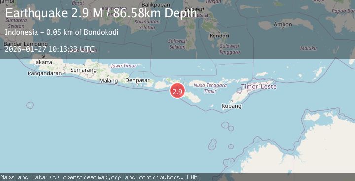
A 2.8 magnitude earthquake struck on Sumbawa Region, Indonesia, at Tue, 27 Jan 2026 10:13:34 GMT. Depth: 82.657219km. Reviewed by BMKG seismologists, this minor quake occurred at a magnitude type of M.
Magnitude
2.8
M
Source
BMKG
Intensity
-
Agency Reports
1 Sources| Source | Magnitude | Depth | Time |
|---|---|---|---|
| BMKGPrimary | 2.8 | 83 km | 2 hours ago |
Earthquake Details
AutomaticEvent IDbmg2026bwhi
Tsunami PotentialNo
Magnitude TypeM
Nearest Places
- Toro Sambe34.9 km
- Teluk Rada34.9 km
- Teluk Mua35.1 km
- Sori Rada35.2 km
- Doro Rada35.4 km
Comments
Join the discussion about this event.
Latest Earthquakes
1.3Mag
16 km W of Johannesburg, CA
Time2 hours ago
Depth6.54 km
SourceUSGS (Automatic)
1.0Mag
45 km NW of Tatitlek, Alaska
Time2 hours ago
Depth13.60 km
SourceUSGS (Automatic)
3.4Mag
West Papua Region, Indonesia
Time2 hours ago
Depth26.26 km
SourceBMKG (Automatic)
2.7Mag
Sulawesi, Indonesia
Time2 hours ago
Depth10.00 km
SourceBMKG (Automatic)
1.4Mag
13 km N of Morgan Hill, CA
Time2 hours ago
Depth3.37 km
SourceUSGS (Automatic)
Nearby Earthquakes
2.1Mag
Sumbawa Region, Indonesia
Time2 days ago
Depth66.59 km
SourceBMKG (Automatic)
2.4Mag
Sumbawa Region, Indonesia
Time3 days ago
Depth10.00 km
SourceBMKG (Automatic)
3.3Mag
Sumbawa Region, Indonesia
Time4 days ago
Depth10.00 km
SourceBMKG (Automatic)
2.1Mag
Sumbawa Region, Indonesia
Time2 days ago
Depth26.23 km
SourceBMKG (Automatic)
2.4Mag
Flores Region, Indonesia
Time5 days ago
Depth10.00 km
SourceBMKG (Automatic)