Earthquake West Papua Region, Indonesia
Tue, 27 Jan 2026 09:58:36 GMT
Time4 hours ago
Location
-3.4039, 135.5871
Depth
25.8 KM
Event Summary
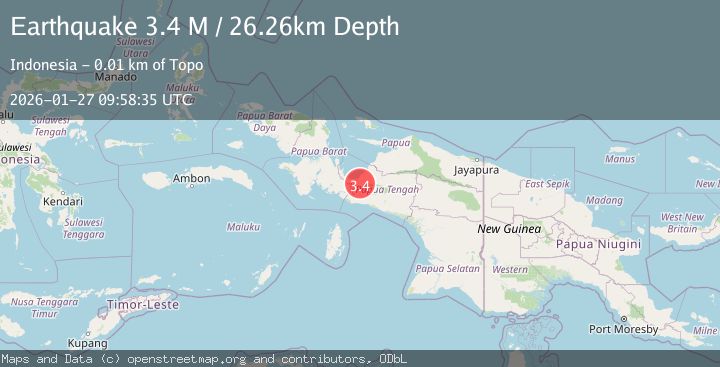
A 3.2 magnitude earthquake struck on West Papua Region, Indonesia, at Tue, 27 Jan 2026 09:58:36 GMT. Depth: 25.779696km. Reviewed by BMKG seismologists, this minor quake occurred at a magnitude type of M.
Magnitude
3.2
M
Source
BMKG
Intensity
-
Agency Reports
1 Sources| Source | Magnitude | Depth | Time |
|---|---|---|---|
| BMKGPrimary | 3.2 | 26 km | 4 hours ago |
Earthquake Details
AutomaticEvent IDbmg2026bwgv
Tsunami PotentialNo
Magnitude TypeM
Nearest Places
- Kampung Topo2.9 km
- Kampung Kali Harapan5.0 km
- Kelurahan Siriwini5.0 km
- Kampung Sanoba5.7 km
- Distrik Nabire6.6 km
Comments
Join the discussion about this event.
Latest Earthquakes
1.0Mag
45 km NW of Tatitlek, Alaska
Time4 hours ago
Depth13.60 km
SourceUSGS (Automatic)
2.7Mag
Sulawesi, Indonesia
Time4 hours ago
Depth10.00 km
SourceBMKG (Automatic)
1.4Mag
13 km N of Morgan Hill, CA
Time4 hours ago
Depth3.37 km
SourceUSGS (Automatic)
2.5Mag
Southern Sumatra, Indonesia
Time4 hours ago
Depth10.48 km
SourceBMKG (Automatic)
4.3Mag
2 km NW of Pāhala, Hawaii
Time4 hours ago
Depth33.60 km
SourceUSGS
Nearby Earthquakes
3.7Mag
West Papua Region, Indonesia
Time11 hours ago
Depth127.10 km
SourceBMKG (Automatic)
2.7Mag
West Papua Region, Indonesia
Time3 days ago
Depth35.26 km
SourceBMKG (Automatic)
2.3Mag
West Papua Region, Indonesia
Time2 days ago
Depth40.13 km
SourceBMKG (Automatic)
3.2Mag
West Papua Region, Indonesia
Time6 days ago
Depth10.00 km
SourceBMKG (Automatic)
2.3Mag
West Papua Region, Indonesia
Time6 days ago
Depth10.00 km
SourceBMKG (Automatic)