Earthquake Sumba Region, Indonesia
Wed, 28 Jan 2026 08:42:43 GMT
Time1 hour ago
Location
-9.6686, 119.8685
Depth
28.0 KM
Event Summary
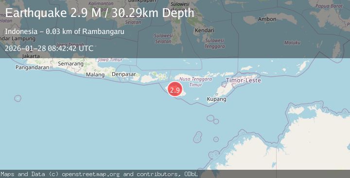
A 2.3 magnitude earthquake struck on Sumba Region, Indonesia, at Wed, 28 Jan 2026 08:42:43 GMT. Depth: 28.022131km. Reviewed by BMKG seismologists, this minor quake occurred at a magnitude type of M.
Magnitude
2.3
M
Source
BMKG
Intensity
-
Agency Reports
1 Sources| Source | Magnitude | Depth | Time |
|---|---|---|---|
| BMKGPrimary | 2.3 | 28 km | 1 hour ago |
Earthquake Details
AutomaticEvent IDbmg2026bxzv
Tsunami PotentialNo
Magnitude TypeM
Nearest Places
- Wundut0.3 km
- Desa Kambata Wundut0.5 km
- Palindi Ngadulanggu1.1 km
- Palindi Lakokur1.3 km
- Nangga1.4 km
Comments
Join the discussion about this event.
Latest Earthquakes
1.5Mag
20 km NNE of Indio, CA
Time1 hour ago
Depth5.17 km
SourceUSGS (Automatic)
2.3Mag
CYPRUS REGION
Time1 hour ago
Depth33.00 km
SourceKOERI (Automatic)
3.4Mag
Northern Sumatra, Indonesia
Time1 hour ago
Depth55.64 km
SourceBMKG (Automatic)
1.5Mag
100 km E of McCarthy, Alaska
Time1 hour ago
Depth5.00 km
SourceUSGS (Automatic)
3.1Mag
Halmahera, Indonesia
Time1 hour ago
Depth10.16 km
SourceBMKG (Automatic)
Nearby Earthquakes
2.6Mag
Sumba Region, Indonesia
Time3 days ago
Depth57.11 km
SourceBMKG (Automatic)
2.7Mag
Sumba Region, Indonesia
Time3 days ago
Depth10.00 km
SourceBMKG (Automatic)
2.6Mag
Sumba Region, Indonesia
Time5 days ago
Depth2.09 km
SourceBMKG (Automatic)
2.5Mag
Sumba Region, Indonesia
Time3 days ago
Depth65.25 km
SourceBMKG (Automatic)
3.1Mag
Sumba Region, Indonesia
Time1 day ago
Depth30.50 km
SourceBMKG (Automatic)