Earthquake Northern Sumatra, Indonesia
Wed, 28 Jan 2026 08:36:32 GMT
Time1 hour ago
Location
4.2811, 96.0463
Depth
56.5 KM
Event Summary
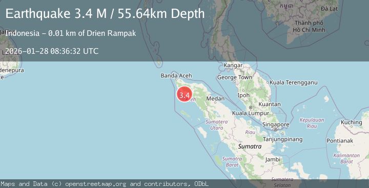
A 3.3 magnitude earthquake struck on Northern Sumatra, Indonesia, at Wed, 28 Jan 2026 08:36:32 GMT. Depth: 56.477402km. Reviewed by BMKG seismologists, this minor quake occurred at a magnitude type of M.
Magnitude
3.3
M
Source
BMKG
Intensity
-
Agency Reports
1 Sources| Source | Magnitude | Depth | Time |
|---|---|---|---|
| BMKGPrimary | 3.3 | 56 km | 1 hour ago |
Earthquake Details
AutomaticEvent IDbmg2026bxzq
Tsunami PotentialNo
Magnitude TypeM
Nearest Places
- Gampong Deuah1.3 km
- Gampong Krueng Tinggai1.4 km
- Gampong Pange1.6 km
- Gampong Pinem2.5 km
- Lubuk2.6 km
Comments
Join the discussion about this event.
Latest Earthquakes
1.5Mag
100 km E of McCarthy, Alaska
Time1 hour ago
Depth5.00 km
SourceUSGS (Automatic)
3.1Mag
Halmahera, Indonesia
Time1 hour ago
Depth10.16 km
SourceBMKG (Automatic)
2.4Mag
CENTRAL CALIFORNIA
Time1 hour ago
Depth3.10 km
SourceNC (Automatic)
1.5Mag
18 km SSW of Lamont, CA
Time1 hour ago
Depth9.92 km
SourceUSGS (Automatic)
1.5Mag
TURKEY-SYRIA-IRAQ BORDER REGION
Time1 hour ago
Depth7.00 km
SourceAFAD (Automatic)
Nearby Earthquakes
2.9Mag
Northern Sumatra, Indonesia
Time2 days ago
Depth30.75 km
SourceBMKG (Automatic)
2.3Mag
Northern Sumatra, Indonesia
Time5 days ago
Depth49.78 km
SourceBMKG (Automatic)
3.3Mag
Northern Sumatra, Indonesia
Time12 hours ago
Depth10.00 km
SourceBMKG (Automatic)
2.1Mag
Northern Sumatra, Indonesia
Time5 days ago
Depth8.15 km
SourceBMKG (Automatic)
2.1Mag
Northern Sumatra, Indonesia
Time4 days ago
Depth4.51 km
SourceBMKG (Automatic)