Earthquake Sumba Region, Indonesia
Wed, 28 Jan 2026 17:10:02 GMT
Time4 hours ago
Location
-9.2432, 120.8089
Depth
63.4 KM
Event Summary
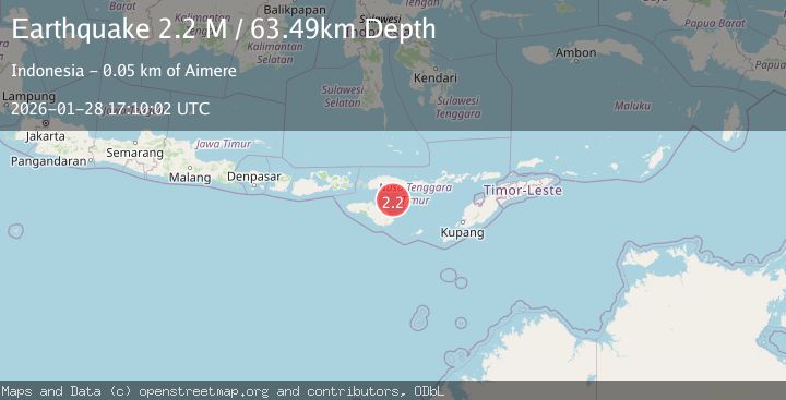
A 2.2 magnitude earthquake struck on Sumba Region, Indonesia, at Wed, 28 Jan 2026 17:10:02 GMT. Depth: 63.370529km. Reviewed by BMKG seismologists, this minor quake occurred at a magnitude type of M.
Magnitude
2.2
M
Source
BMKG
Intensity
-
Agency Reports
1 Sources| Source | Magnitude | Depth | Time |
|---|---|---|---|
| BMKGPrimary | 2.2 | 63 km | 4 hours ago |
Earthquake Details
AutomaticEvent IDbmg2026byqp
Tsunami PotentialNo
Magnitude TypeM
Nearest Places
- Leko Lowe37.0 km
- Ngalu Rita37.0 km
- Leko Nage37.0 km
- Leko Radamude37.0 km
- Ngalu Bere37.0 km
Comments
Join the discussion about this event.
Latest Earthquakes
1.3Mag
15 km ESE of Lake Pillsbury, CA
Time4 hours ago
Depth9.06 km
SourceUSGS (Automatic)
2.7Mag
Minahassa Peninsula, Sulawesi
Time4 hours ago
Depth10.00 km
SourceBMKG (Automatic)
0.8Mag
2 km ESE of Fairbanks, Alaska
Time5 hours ago
Depth18.10 km
SourceUSGS (Automatic)
2.6Mag
Minahassa Peninsula, Sulawesi
Time5 hours ago
Depth132.63 km
SourceBMKG (Automatic)
2.7Mag
Sunda Strait, Indonesia
Time5 hours ago
Depth0.85 km
SourceBMKG (Automatic)
Nearby Earthquakes
2.2Mag
Savu Sea
Time1 day ago
Depth56.18 km
SourceBMKG (Automatic)
3.1Mag
Sumba Region, Indonesia
Time2 days ago
Depth7.25 km
SourceBMKG (Automatic)
2.3Mag
Sumba Region, Indonesia
Time1 day ago
Depth57.08 km
SourceBMKG (Automatic)
2.2Mag
Sumba Region, Indonesia
Time1 week ago
Depth6.25 km
SourceBMKG (Automatic)
2.1Mag
Sumba Region, Indonesia
Time2 days ago
Depth24.50 km
SourceBMKG (Automatic)