Earthquake Sumba Region, Indonesia
Thu, 29 Jan 2026 03:42:00 GMT
Time2 hours ago
Location
-9.3783, 119.3001
Depth
24.1 KM
Event Summary
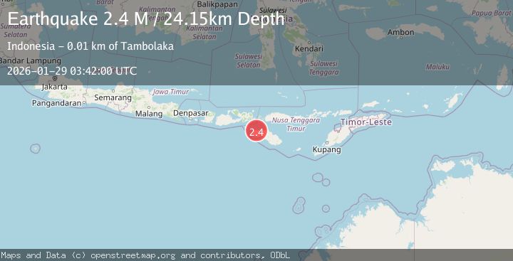
A 2.4 magnitude earthquake struck on Sumba Region, Indonesia, at Thu, 29 Jan 2026 03:42:00 GMT. Depth: 24.149231km. Reviewed by BMKG seismologists, this minor quake occurred at a magnitude type of M.
Magnitude
2.4
M
Source
BMKG
Intensity
-
Agency Reports
1 Sources| Source | Magnitude | Depth | Time |
|---|---|---|---|
| BMKGPrimary | 2.4 | 24 km | 2 hours ago |
Earthquake Details
AutomaticEvent IDbmg2026bzlk
Tsunami PotentialNo
Magnitude TypeM
Nearest Places
- Kalembubila0.5 km
- Loko Karuni2.0 km
- Loko Bokot2.1 km
- Pamareget2.4 km
- Pondokabumbau2.4 km
Comments
Join the discussion about this event.
Latest Earthquakes
2.5Mag
36 km SSE of Livengood, Alaska
Time2 hours ago
Depth1.60 km
SourceUSGS (Automatic)
1.3Mag
11 km ENE of Ridgecrest, CA
Time2 hours ago
Depth3.18 km
SourceUSGS (Automatic)
3.5Mag
NEAR COAST OF NICARAGUA
Time2 hours ago
Depth23.00 km
SourceINET (Automatic)
3.3Mag
JUJUY, ARGENTINA
Time2 hours ago
Depth222.00 km
SourceNSNA (Automatic)
3.3Mag
Southern Sumatra, Indonesia
Time2 hours ago
Depth80.85 km
SourceBMKG (Automatic)
Nearby Earthquakes
2.3Mag
Sumba Region, Indonesia
Time2 days ago
Depth63.48 km
SourceBMKG (Automatic)
2.4Mag
Sumba Region, Indonesia
Time1 day ago
Depth53.59 km
SourceBMKG (Automatic)
2.3Mag
Sumba Region, Indonesia
Time15 hours ago
Depth41.02 km
SourceBMKG (Automatic)
2.3Mag
Sumba Region, Indonesia
Time11 hours ago
Depth8.14 km
SourceBMKG (Automatic)
2.5Mag
Sumba Region, Indonesia
Time5 hours ago
Depth22.63 km
SourceBMKG (Automatic)