Earthquake Bali Sea
Thu, 29 Jan 2026 05:24:40 GMT
Time3 hours ago
Location
-7.9810, 117.6393
Depth
10.0 KM
Event Summary
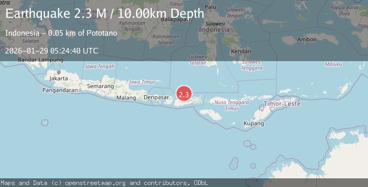
A 2.3 magnitude earthquake struck on Bali Sea, at Thu, 29 Jan 2026 05:24:40 GMT. Depth: 10km. Reviewed by BMKG seismologists, this minor quake occurred at a magnitude type of M.
Magnitude
2.3
M
Source
BMKG
Intensity
-
Agency Reports
1 Sources| Source | Magnitude | Depth | Time |
|---|---|---|---|
| BMKGPrimary | 2.3 | 10 km | 3 hours ago |
Earthquake Details
AutomaticEvent IDbmg2026bzou
Tsunami PotentialNo
Magnitude TypeM
Nearest Places
- Satonda Peak18.1 km
- Pulau Satonda18.5 km
- Tanjung Panda18.8 km
- Ndano Satonda18.8 km
- Teluk Patedong19.0 km
Comments
Join the discussion about this event.
Latest Earthquakes
1.9Mag
36 km NNW of Toyah, Texas
Time3 hours ago
Depth5.75 km
SourceUSGS (Automatic)
3.0Mag
Timor Region
Time3 hours ago
Depth10.00 km
SourceBMKG (Automatic)
2.0Mag
NORTHERN ITALY
Time4 hours ago
Depth9.40 km
SourceINGV (Automatic)
1.0Mag
83 km NNW of Karluk, Alaska
Time4 hours ago
Depth5.00 km
SourceUSGS (Automatic)
2.5Mag
Southern Sumatra, Indonesia
Time4 hours ago
Depth15.67 km
SourceBMKG (Automatic)
Nearby Earthquakes
2.1Mag
Bali Sea
Time4 days ago
Depth8.11 km
SourceBMKG (Automatic)
2.4Mag
Bali Sea
Time3 days ago
Depth10.00 km
SourceBMKG (Automatic)
2.2Mag
Bali Sea
Time2 days ago
Depth23.43 km
SourceBMKG (Automatic)
2.3Mag
Bali Sea
Time1 day ago
Depth13.31 km
SourceBMKG (Automatic)
2.2Mag
Sumbawa Region, Indonesia
Time5 days ago
Depth10.00 km
SourceBMKG (Automatic)