Earthquake Bali Sea
Tue, 27 Jan 2026 00:59:15 GMT
Time9 hours ago
Location
-7.9264, 117.6299
Depth
23.4 KM
Event Summary
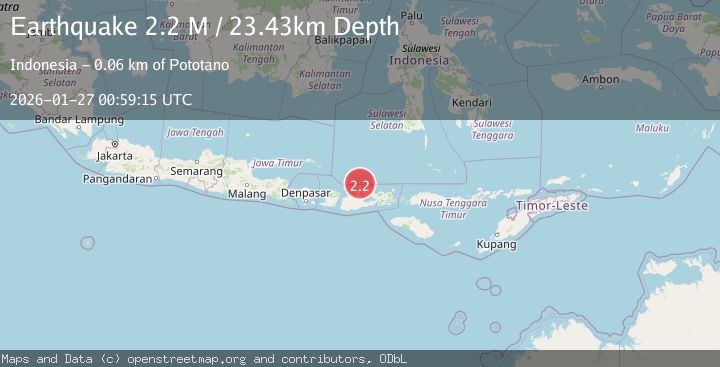
A 2.2 magnitude earthquake struck on Bali Sea, at Tue, 27 Jan 2026 00:59:15 GMT. Depth: 23.432447km. Reviewed by BMKG seismologists, this minor quake occurred at a magnitude type of M.
Magnitude
2.2
M
Source
BMKG
Intensity
-
Agency Reports
1 Sources| Source | Magnitude | Depth | Time |
|---|---|---|---|
| BMKGPrimary | 2.2 | 23 km | 9 hours ago |
Earthquake Details
AutomaticEvent IDbmg2026bvpa
Tsunami PotentialNo
Magnitude TypeM
Nearest Places
- Satonda Peak23.5 km
- Pulau Satonda24.0 km
- Ndano Satonda24.3 km
- Tanjung Panda24.9 km
- Sebaru25.1 km
Comments
Join the discussion about this event.
Latest Earthquakes
3.2Mag
OFF W. COAST OF S. ISLAND, N.Z.
Time9 hours ago
Depth30.60 km
SourceGNS (Automatic)
3.7Mag
West Papua, Indonesia
Time9 hours ago
Depth73.14 km
SourceBMKG (Automatic)
4.4Mag
COOK STRAIT, NEW ZEALAND
Time9 hours ago
Depth24.80 km
SourceGNS (Automatic)
3.7Mag
Talaud Islands, Indonesia
Time9 hours ago
Depth129.80 km
SourceBMKG (Automatic)
0.8Mag
9 km WNW of The Geysers, CA
Time9 hours ago
Depth1.50 km
SourceUSGS (Automatic)
Nearby Earthquakes
2.4Mag
Bali Sea
Time1 day ago
Depth10.00 km
SourceBMKG (Automatic)
2.1Mag
Bali Sea
Time2 days ago
Depth8.11 km
SourceBMKG (Automatic)
2.3Mag
Bali Sea
Time3 days ago
Depth10.00 km
SourceBMKG (Automatic)
2.2Mag
Sumbawa Region, Indonesia
Time3 days ago
Depth10.00 km
SourceBMKG (Automatic)
2.3Mag
Bali Sea
Time3 days ago
Depth10.00 km
SourceBMKG (Automatic)