Earthquake Sumbawa Region, Indonesia
Thu, 29 Jan 2026 05:31:21 GMT
Time3 hours ago
Location
-9.1103, 116.7592
Depth
11.3 KM
Event Summary
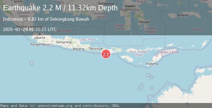
A 2.2 magnitude earthquake struck on Sumbawa Region, Indonesia, at Thu, 29 Jan 2026 05:31:21 GMT. Depth: 11.317306km. Reviewed by BMKG seismologists, this minor quake occurred at a magnitude type of M.
Magnitude
2.2
M
Source
BMKG
Intensity
-
Agency Reports
1 Sources| Source | Magnitude | Depth | Time |
|---|---|---|---|
| BMKGPrimary | 2.2 | 11 km | 3 hours ago |
Earthquake Details
AutomaticEvent IDbmg2026bzpa
Tsunami PotentialNo
Magnitude TypeM
Nearest Places
- Sejorong9.7 km
- Brang Sejorong10.2 km
- Brang Senyur10.4 km
- Tanjung Mangkun10.8 km
- Teluk Senutuk11.5 km
Comments
Join the discussion about this event.
Latest Earthquakes
0.5Mag
8 km WNW of The Geysers, CA
Time3 hours ago
Depth1.16 km
SourceUSGS (Automatic)
2.3Mag
Bali Sea
Time3 hours ago
Depth10.00 km
SourceBMKG (Automatic)
1.9Mag
36 km NNW of Toyah, Texas
Time3 hours ago
Depth5.75 km
SourceUSGS (Automatic)
3.0Mag
Timor Region
Time4 hours ago
Depth10.00 km
SourceBMKG (Automatic)
2.0Mag
NORTHERN ITALY
Time4 hours ago
Depth9.40 km
SourceINGV (Automatic)
Nearby Earthquakes
4.0Mag
Sumbawa Region, Indonesia
Time1 day ago
Depth100.44 km
SourceBMKG (Automatic)
2.2Mag
Sumbawa Region, Indonesia
Time2 days ago
Depth72.67 km
SourceBMKG (Automatic)
2.6Mag
Sumbawa Region, Indonesia
Time6 days ago
Depth5.67 km
SourceBMKG (Automatic)
2.1Mag
Sumbawa Region, Indonesia
Time5 days ago
Depth10.00 km
SourceBMKG (Automatic)
2.3Mag
Sumbawa Region, Indonesia
Time1 week ago
Depth10.00 km
SourceBMKG (Automatic)